Area Overview for NE66 1BA
Photos of NE66 1BA
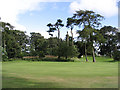
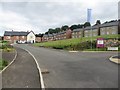
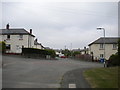
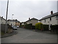
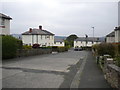
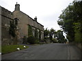
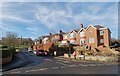

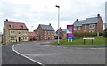
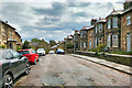
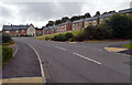
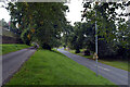
56 photos from this area
Area Information
Key information about the NE66 1BA including its size, population, and administrative classification.
- Area Type
- Postcode
- Area Size
- 2.6 hectares
- Population
- 1538
- Population Density
- 1855 people/km²
House Prices in NE66 1BA
18
Properties
£212,192
Average Sold Price
£80,000
Lowest Price
£415,000
Highest Price
Showing 18 properties
| Address | Type | Beds | Baths | Last Sale Price | Last Sale Date | |
|---|---|---|---|---|---|---|
| Pinetrees, 37 Blakelaw Road, Alnwick, NE66 1BA | Bungalow | 3 | 2 | £415,000 | Sep 2023 | |
| 34 Blakelaw Road, Alnwick, NE66 1BA | house | - | - | £275,000 | Sep 2021 | |
| 42 Blakelaw Road, Alnwick, NE66 1BA | Bungalow | - | - | £170,000 | Dec 2019 | |
| 43 Blakelaw Road, Alnwick, NE66 1BA | Detached | 4 | 3 | £325,000 | Nov 2016 | |
| 46 Blakelaw Road, Alnwick, NE66 1BA | house | - | - | £185,000 | Sep 2016 | |
| Crosshills House, 40 Blakelaw Road, Alnwick, NE66 1BA | Detached | 5 | - | £330,000 | Nov 2015 | |
| 33 Blakelaw Road, Alnwick, NE66 1BA | house | - | - | £186,500 | Sep 2015 | |
| 41 Blakelaw Road, Alnwick, NE66 1BA | Detached | 4 | 2 | £245,000 | Jul 2015 | |
| 45 Blakelaw Road, Alnwick, NE66 1BA | Bungalow | 2 | 1 | £178,000 | Feb 2015 | |
| 47 Blakelaw Road, Alnwick, NE66 1BA | Semi-detached | 3 | - | £150,000 | Jul 2013 |
Page 1 of 2
Energy Efficiency in NE66 1BA
Amenities
Schools
| Rank | School | Type | Entry gender | Ages |
|---|
Explore more schools in this area
Go to Schools tabDemographics
Household Size
Two person
most common
Accommodation Type
Houses
most common
Tenure
77
majority
Ethnic Group
White
most common
Religion
N/A
most common
Household Composition
N/A
most common
Age
47
median
Adults (30-64 years)
most common
Household Deprivation
N/A
with no deprivation
NS-SEC
42
in Lower managerial occupations
Explore more demographic insights in this area
Go to Demographics tabPlanning
Planning Constraints
- Flood RiskPremium
- Ramsar Wetland SitesPremium
- Area of Outstanding Natural BeautyPremium
- Protected Nature ReservePremium
- Protected WoodlandPremium