Area Overview for NE65 9TY
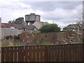
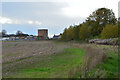
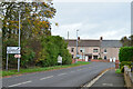
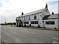
Photos of NE65 9TY
Area Information
Living in NE65 9TY means residing within a compact residential cluster of 2,457 square metres that serves 2,617 people. This specific postcode area is defined by its density and intimate scale, creating a neighbourhood where residents are likely familiar with their surroundings. The community is overwhelmingly populated by adults aged between 30 and 64 years, forming a stable demographic often found in established housing markets. Families and long-term residents dominate this space, which distinguishes itself from the transient areas frequently found in major city centres. When you consider homes in NE65 9TY, you are entering a settlement where the population density sits at 120 people per square kilometre. This figure indicates a comfortable lack of overcrowding while maintaining a close-knit social fabric typical of smaller English settlements. Daily life here revolves around a consistent routine supported by local amenities and reliable transport links, free from the chaos of larger conurbations. The area stands as a practical choice for those seeking a grounded lifestyle without the overwhelming size of a major town.
- Area Type
- Postcode
- Area Size
- 2457 m²
- Population
- 2617
- Population Density
- 120 people/km²
The property market in NE65 9TY is heavily skewed towards owner-occupiers rather than private landladies or agency rentals. A staggering 80 per cent of the 2,617 residents here hold a title deed to their accommodation. This statistic signals a quiet but steadfast demand for permanence and stability within the local estate. The housing stock consists almost exclusively of houses, erasing the possibility of finding a flat or purpose-built apartment block within these boundaries. For you, looking at homes in NE65 9TY, this means the traditional detached or semi-detached bungalow feels is the norm, not the exception. You are unlikely to encounter the rental turnover that characterises university towns or commuter belts near Manchester. Instead, the market operates on a slower pace where sellers are family members or long-term investors holding property for the long haul. This environment often results in fewer viewings but potentially less frantic competition compared to flashier commuter hubs. The sheer size of the area, at just 2,457 square metres, further limits the inventory available for sale.
House Prices in NE65 9TY
Showing 11 properties
| Address | Type | Beds | Baths | Last Sale Price | Last Sale Date | |
|---|---|---|---|---|---|---|
| 6 School Row, North Broomhill, NE65 9TY | Terraced | 2 | 1 | £115,000 | Sep 2025 | |
| 8 School Row, North Broomhill, NE65 9TY | Terraced | 2 | 1 | £100,000 | Aug 2025 | |
| 5 School Row, North Broomhill, NE65 9TY | house | - | - | £72,500 | Aug 2021 | |
| 7 School Row, North Broomhill, NE65 9TY | house | - | - | £82,500 | Aug 2020 | |
| 2 School Row, North Broomhill, NE65 9TY | Terraced | 2 | 1 | £66,000 | Jun 2020 | |
| 3 School Row, North Broomhill, NE65 9TY | Terraced | - | - | £23,250 | Nov 1997 | |
| 11 School Row, North Broomhill, NE65 9TY | Terraced | - | - | - | - | |
| 10 School Row, North Broomhill, NE65 9TY | Terraced | - | - | - | - | |
| 9 School Row, North Broomhill, NE65 9TY | Terraced | - | - | - | - | |
| 4 School Row, North Broomhill, NE65 9TY | Terraced | - | - | - | - |
Energy Efficiency in NE65 9TY
Living in NE65 9TY offers direct access to specific retail and transport amenities that support daily convenience. Your nearest shopping options include Co-op Hadston, Morrisons Amble, and Co-op Amble. These three venues provide the essential groceries and daily necessities required by households without needing a long journey into a city centre. For those who require these trips be spontaneous, having a supermarket within practical reach is a significant advantage. Beyond retail, the area boasts five railway stations in good proximity: Acklington Railway Station, a general Railway station, and Widdrington Railway Station. These transport nodes are key to your mobility, allowing quick departures for work or leisure to destinations beyond the immediate vicinity. The combination of local food shopping and rail links creates a self-sufficient lifestyle loop. You can manage your household needs locally while retaining the option to travel further afield quickly. This blend of local retail and strong rail access defines the practical rhythm of life for anyone calling this postcode home.
Amenities
Schools
Families considering schools near NE65 9TY have access to several options within practical reach. Two primary schools hold an Ofsted rating of good: Broomhill Primary School and Red Row Primary School. Both institutions provide a quality education for younger children based on current standards. A third option exists at James Calvert Spence College on Hadston Road, which also serves the primary age group, though its specific rating is not listed in the available records. This mix ensures that families do not need to travel far for early education. The presence of multiple primary providers suggests a distributed network where parents can choose based on catchment zone or preference rather than a single monopoly. For older children, the data does not provide secondary school names, but the primary setup indicates a community that invests in foundational education. When you look at the demographic of adults aged 30 to 64, the desire for reputable schools like Broomhill and Red Row is a natural driver for those purchasing property here.
| Rank | School | Type | Entry gender | Ages |
|---|
Explore more schools in this area
Go to Schools tabDemographics
The community profile in NE65 9TY is defined by stability and maturity. With a median age of 47 years, the demographic heart of the area beats for middle-aged adults. More than half the population falls into the 30 to 64 years age range, suggesting a distinct lack of young families or the elderly typically found in retirement villages. Home ownership dominates the landscape, with 80 per cent of residents owning their homes outright or with a mortgage. This high ownership rate points to a market where people stay put for decades rather than chasing short-term rental opportunities. Houses serve as the primary accommodation type throughout NE65 9TY, meaning you will not find a mix of apartments or high-rise flats. The racial makeup is predominantly White, reflecting the traditional character of this English settlement. There is no data regarding deprivation in the provided records, so any assessment of income levels or social mobility remains strictly limited to what national averages might suggest for such demographic clusters.
Household Size
Accommodation Type
Tenure
Ethnic Group
Religion
Household Composition
Age
Household Deprivation
NS-SEC
Explore more demographic insights in this area
Go to Demographics tabPlanning
Planning Constraints
- Flood RiskPremium
- Ramsar Wetland SitesPremium
- Area of Outstanding Natural BeautyPremium
- Protected Nature ReservePremium
- Protected WoodlandPremium