Area Overview for NE65 9SF
Photos of NE65 9SF

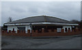
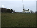
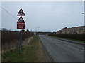
21 photos from this area
Area Information
Key information about the NE65 9SF including its size, population, and administrative classification.
- Area Type
- Postcode
- Area Size
- 7361 m²
- Population
- 2617
- Population Density
- 120 people/km²
House Prices in NE65 9SF
4
Properties
£20,000
Average Sold Price
£20,000
Lowest Price
£20,000
Highest Price
Showing 4 properties
| Address | Type | Beds | Baths | Last Sale Price | Last Sale Date | |
|---|---|---|---|---|---|---|
| Old Ambulance Station, Hadston Road, Hadston, NE65 9SF | Detached | - | - | £20,000 | Nov 2000 | |
| J Duncan Dental Practice, Health Centre, Hadston Road, Hadston, NE65 9SF | commercial | - | - | - | - | |
| Local Recycling Point, East Chevington Social Club, Hadston Road, Hadston, NE65 9SF | commercial | - | - | - | - | |
| Northumberland Care Trust, Broomhill Health Centre, Hadston Road, Hadston, NE65 9SF | primary_healthcare | - | - | - | - |
Energy Efficiency in NE65 9SF
Amenities
Schools
| Rank | School | Type | Entry gender | Ages |
|---|
Explore more schools in this area
Go to Schools tabDemographics
Household Size
Two person
most common
Accommodation Type
Houses
most common
Tenure
80
majority
Ethnic Group
White
most common
Religion
N/A
most common
Household Composition
N/A
most common
Age
47
median
Adults (30-64 years)
most common
Household Deprivation
N/A
with no deprivation
NS-SEC
15
in Lower managerial occupations
Explore more demographic insights in this area
Go to Demographics tabPlanning
Planning Constraints
- Flood RiskPremium
- Ramsar Wetland SitesPremium
- Area of Outstanding Natural BeautyPremium
- Protected Nature ReservePremium
- Protected WoodlandPremium