Area Overview for NE65 7RN
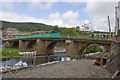
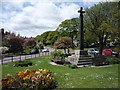
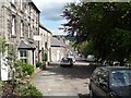
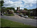
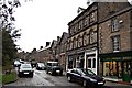
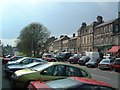
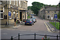
Photos of NE65 7RN
Area Information
Living in NE65 7RN offers a quiet, low-density residential experience in a small cluster of homes spread across a rural or semi-rural setting. With a population of 1,673 and a density of just 12 people per square kilometre, this area feels distinctly uncluttered. The community is predominantly composed of adults aged 30–64, with a median age of 47, suggesting a stable, mature demographic. Houses are the primary form of accommodation, reflecting a home-ownership rate of 62%, which indicates a mix of long-term residents and families. The area’s proximity to Rothbury First School and other local institutions ensures access to essential services, while the low population density suggests a focus on private, spacious living rather than urban convenience. For those seeking a peaceful, low-traffic environment with a strong sense of community, NE65 7RN provides a foundation of stability and quietude, though its small size means amenities are limited to immediate surroundings.
- Area Type
- Postcode
- Area Size
- Not available
- Population
- 1673
- Population Density
- 12 people/km²
The property market in NE65 7RN is shaped by its low population density and high home-ownership rate of 62%. With houses as the primary accommodation type, the area is not heavily reliant on rental properties, suggesting a market driven by owner-occupiers rather than investors. This dynamic may result in a more stable, long-term housing stock, with properties likely to retain value due to limited supply. However, the small size of the area means the housing stock is constrained, and buyers may find fewer options compared to larger towns or cities. The predominance of houses over flats or apartments also indicates a preference for private, spacious living, which may appeal to families or those seeking a quieter, less congested environment. Prospective buyers should consider the area’s limited size and the potential for limited development in the immediate future.
House Prices in NE65 7RN
No properties found in this postcode.
Energy Efficiency in NE65 7RN
The lifestyle in NE65 7RN is characterised by proximity to essential retail services, with Co-op Rothbury and Spar Thropton providing nearby shopping options. These stores offer convenience for daily needs, from groceries to essentials, reducing the necessity for long trips to larger centres. Beyond retail, the area’s low density and small size suggest a focus on private spaces and community cohesion over large-scale leisure facilities. While no parks or dining venues are explicitly listed in the data, the presence of schools and retail spots indicates a functional, self-contained environment. The limited amenities mean residents may need to travel for more specialised services, but the area’s charm lies in its simplicity and the ease of accessing nearby essentials without urban congestion.
Amenities
Schools
Residents of NE65 7RN have access to a range of educational institutions, including Rothbury First School, a primary school with a good Ofsted rating, and Dr Thomlinson Church of England Middle School, which operates as both a primary school and an academy. The Nunnykirk Centre for Dyslexia, a special school, provides tailored support for students with specific learning needs. This mix of school types ensures families can find options suited to their children’s requirements, from mainstream primary education to specialist support. The presence of multiple schools within proximity suggests a commitment to local education, though the absence of secondary schools means older students may need to travel further for secondary education. For families prioritising proximity to schools, the availability of both mainstream and specialist institutions is a key advantage.
| Rank | School | Type | Entry gender | Ages |
|---|
Explore more schools in this area
Go to Schools tabDemographics
The community in NE65 7RN is defined by its mature age profile, with a median age of 47 and the majority of residents falling within the 30–64 age range. This suggests a population of working-age adults and families with children, though the absence of data on younger demographics means the area may lack a significant student or younger professional cohort. Home ownership is strong, at 62%, with houses being the dominant type of accommodation. The predominant ethnic group is White, though no specific data on diversity or deprivation is provided. This demographic profile implies a relatively stable, low-turnover community, where long-term residency is common. The lack of high-density housing or rental properties further reinforces the area’s character as a place for settled, family-oriented living rather than transient populations.
Household Size
Accommodation Type
Tenure
Ethnic Group
Religion
Household Composition
Age
Household Deprivation
NS-SEC
Explore more demographic insights in this area
Go to Demographics tabPlanning
Planning Constraints
- Flood RiskPremium
- Ramsar Wetland SitesPremium
- Area of Outstanding Natural BeautyPremium
- Protected Nature ReservePremium
- Protected WoodlandPremium