Area Overview for NE65 0JA
Photos of NE65 0JA
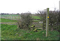
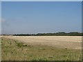
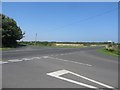
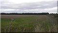

21 photos from this area
Area Information
Key information about the NE65 0JA including its size, population, and administrative classification.
- Area Type
- Postcode
- Area Size
- 1.5 hectares
- Population
- 1758
- Population Density
- 803 people/km²
House Prices in NE65 0JA
35
Properties
£164,190
Average Sold Price
£52,000
Lowest Price
£270,000
Highest Price
Showing 35 properties
| Address | Type | Beds | Baths | Last Sale Price | Last Sale Date | |
|---|---|---|---|---|---|---|
| 97 Gloster Park, Amble, NE65 0JA | Semi-detached | 2 | 1 | £229,000 | Sep 2025 | |
| 90 Gloster Park, Amble, NE65 0JA | Bungalow | 2 | 1 | £200,000 | Sep 2024 | |
| 96 Gloster Park, Amble, NE65 0JA | Detached | 3 | 1 | £270,000 | Feb 2024 | |
| 80 Gloster Park, Amble, NE65 0JA | Bungalow | 2 | 1 | £220,000 | May 2023 | |
| 94 Gloster Park, Amble, NE65 0JA | Bungalow | 2 | 1 | £217,500 | Dec 2022 | |
| 87 Gloster Park, Amble, NE65 0JA | Detached | 3 | 2 | £250,000 | Dec 2022 | |
| 77 Gloster Park, Amble, NE65 0JA | Retail | 2 | 1 | £240,000 | Oct 2022 | |
| 95 Gloster Park, Amble, NE65 0JA | Bungalow | 2 | 1 | £210,000 | Aug 2022 | |
| 99 Gloster Park, Amble, NE65 0JA | Bungalow | 2 | 1 | £170,000 | Apr 2020 | |
| 85 Gloster Park, Amble, NE65 0JA | Bungalow | 3 | 2 | £213,000 | Aug 2018 |
Page 1 of 4
Energy Efficiency in NE65 0JA
Amenities
Schools
| Rank | School | Type | Entry gender | Ages |
|---|
Explore more schools in this area
Go to Schools tabDemographics
Household Size
Two person
most common
Accommodation Type
Houses
most common
Tenure
82
majority
Ethnic Group
White
most common
Religion
N/A
most common
Household Composition
N/A
most common
Age
47
median
Adults (30-64 years)
most common
Household Deprivation
N/A
with no deprivation
NS-SEC
32
in Lower managerial occupations
Explore more demographic insights in this area
Go to Demographics tabPlanning
Planning Constraints
- Flood RiskPremium
- Ramsar Wetland SitesPremium
- Area of Outstanding Natural BeautyPremium
- Protected Nature ReservePremium
- Protected WoodlandPremium