Area Overview for NE65 0HA
Photos of NE65 0HA

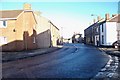
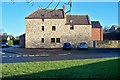
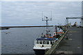
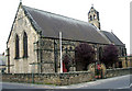
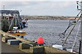
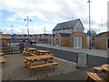
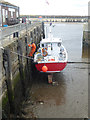

100 photos from this area
Area Information
Key information about the NE65 0HA including its size, population, and administrative classification.
- Area Type
- Postcode
- Area Size
- 2.9 hectares
- Population
- 1638
- Population Density
- 2028 people/km²
House Prices in NE65 0HA
50
Properties
£82,082
Average Sold Price
£27,075
Lowest Price
£130,000
Highest Price
Showing 50 properties
| Address | Type | Beds | Baths | Last Sale Price | Last Sale Date | |
|---|---|---|---|---|---|---|
| 14 Straffen Court, Amble, NE65 0HA | house | - | - | £130,000 | Nov 2023 | |
| 39 Straffen Court, Amble, NE65 0HA | Terraced | 3 | 2 | £112,500 | Jun 2023 | |
| 49 Straffen Court, Amble, NE65 0HA | Terraced | 3 | 1 | £95,000 | Dec 2020 | |
| 26 Straffen Court, Amble, NE65 0HA | Terraced | 2 | 1 | £86,000 | Aug 2017 | |
| 9 Straffen Court, Amble, NE65 0HA | house | 3 | 1 | £93,000 | Jun 2016 | |
| 8 Straffen Court, Amble, NE65 0HA | Terraced | - | - | £27,075 | Feb 2004 | |
| 6 Straffen Court, Amble, NE65 0HA | house | - | - | £31,000 | Mar 1995 | |
| 1 Straffen Court, Amble, NE65 0HA | Terraced | 3 | 1 | - | - | |
| 28 Straffen Court, Amble, NE65 0HA | Detached | 3 | 1 | - | - | |
| The Vicarage, Straffen Court, Amble, NE65 0HA | house | - | - | - | - |
Page 1 of 5
Energy Efficiency in NE65 0HA
Amenities
Schools
| Rank | School | Type | Entry gender | Ages |
|---|
Explore more schools in this area
Go to Schools tabDemographics
Household Size
Two person
most common
Accommodation Type
Houses
most common
Tenure
65
majority
Ethnic Group
White
most common
Religion
N/A
most common
Household Composition
N/A
most common
Age
47
median
Adults (30-64 years)
most common
Household Deprivation
N/A
with no deprivation
NS-SEC
24
in Lower managerial occupations
Explore more demographic insights in this area
Go to Demographics tabPlanning
Planning Constraints
- Flood RiskPremium
- Ramsar Wetland SitesPremium
- Area of Outstanding Natural BeautyPremium
- Protected Nature ReservePremium
- Protected WoodlandPremium