Area Overview for NE65 0GB
Photos of NE65 0GB
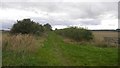
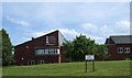

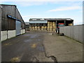
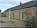
21 photos from this area
Area Information
Key information about the NE65 0GB including its size, population, and administrative classification.
- Area Type
- Postcode
- Area Size
- 2.0 hectares
- Population
- 1758
- Population Density
- 803 people/km²
House Prices in NE65 0GB
17
Properties
£143,059
Average Sold Price
£51,950
Lowest Price
£372,500
Highest Price
Showing 17 properties
| Address | Type | Beds | Baths | Last Sale Price | Last Sale Date | |
|---|---|---|---|---|---|---|
| 11 Sylvias Close, Amble, NE65 0GB | Detached | 4 | 3 | £295,000 | Jul 2024 | |
| 4 Sylvias Close, Amble, NE65 0GB | Detached | 4 | 2 | £372,500 | Feb 2024 | |
| 9 Sylvias Close, Amble, NE65 0GB | Bungalow | - | - | £265,000 | Jan 2021 | |
| 15 Sylvias Close, Amble, NE65 0GB | house | 3 | - | £123,000 | Oct 2014 | |
| 1 Sylvias Close, Amble, NE65 0GB | Bungalow | 3 | 2 | £177,950 | Dec 2010 | |
| 17 Sylvias Close, Amble, NE65 0GB | Detached | 4 | 2 | £190,000 | Aug 2010 | |
| 6 Sylvias Close, Amble, NE65 0GB | Semi-detached | - | - | £149,000 | Jan 2009 | |
| 13 Sylvias Close, Amble, NE65 0GB | Semi-detached | - | - | £134,950 | Apr 2008 | |
| 14 Sylvias Close, Amble, NE65 0GB | Detached | - | - | £142,000 | Jul 2003 | |
| 12 Sylvias Close, Amble, NE65 0GB | Semi-detached | 3 | - | £63,000 | Dec 2001 |
Page 1 of 2
Energy Efficiency in NE65 0GB
Amenities
Schools
| Rank | School | Type | Entry gender | Ages |
|---|
Explore more schools in this area
Go to Schools tabDemographics
Household Size
Two person
most common
Accommodation Type
Houses
most common
Tenure
82
majority
Ethnic Group
White
most common
Religion
N/A
most common
Household Composition
N/A
most common
Age
47
median
Adults (30-64 years)
most common
Household Deprivation
N/A
with no deprivation
NS-SEC
32
in Lower managerial occupations
Explore more demographic insights in this area
Go to Demographics tabPlanning
Planning Constraints
- Flood RiskPremium
- Ramsar Wetland SitesPremium
- Area of Outstanding Natural BeautyPremium
- Protected Nature ReservePremium
- Protected WoodlandPremium