Area Overview for NE63 9SW
Photos of NE63 9SW
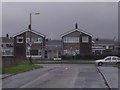
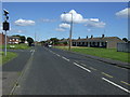
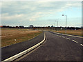
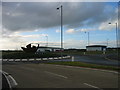
14 photos from this area
Area Information
Key information about the NE63 9SW including its size, population, and administrative classification.
- Area Type
- Postcode
- Area Size
- 1.7 hectares
- Population
- 2283
- Population Density
- 1812 people/km²
House Prices in NE63 9SW
42
Properties
£92,950
Average Sold Price
£35,500
Lowest Price
£165,000
Highest Price
Showing 42 properties
| Address | Type | Beds | Baths | Last Sale Price | Last Sale Date | |
|---|---|---|---|---|---|---|
| 7 Belgrave Gardens, North Seaton, NE63 9SW | Semi-detached | 3 | 1 | £165,000 | Jul 2025 | |
| 19 Belgrave Gardens, North Seaton, NE63 9SW | Semi-detached | 3 | - | £150,000 | May 2024 | |
| 35 Belgrave Gardens, North Seaton, NE63 9SW | Bungalow | - | - | £125,000 | Mar 2024 | |
| 44 Belgrave Gardens, North Seaton, NE63 9SW | Bungalow | - | - | £103,500 | Jan 2022 | |
| 28 Belgrave Gardens, North Seaton, NE63 9SW | Bungalow | - | - | £147,000 | Nov 2021 | |
| 30 Belgrave Gardens, North Seaton, NE63 9SW | Bungalow | - | - | £80,000 | Aug 2020 | |
| 37 Belgrave Gardens, North Seaton, NE63 9SW | Bungalow | 2 | 1 | £85,000 | Feb 2020 | |
| 18 Belgrave Gardens, North Seaton, NE63 9SW | Bungalow | 2 | 1 | £78,000 | Aug 2017 | |
| 9 Belgrave Gardens, North Seaton, NE63 9SW | house | - | - | £124,500 | Nov 2016 | |
| 32 Belgrave Gardens, North Seaton, NE63 9SW | Bungalow | 2 | 1 | £90,000 | Oct 2016 |
Page 1 of 5
Energy Efficiency in NE63 9SW
Amenities
Schools
| Rank | School | Type | Entry gender | Ages |
|---|
Explore more schools in this area
Go to Schools tabDemographics
Household Size
One person
most common
Accommodation Type
Houses
most common
Tenure
52
majority
Ethnic Group
White
most common
Religion
N/A
most common
Household Composition
N/A
most common
Age
47
median
Adults (30-64 years)
most common
Household Deprivation
N/A
with no deprivation
NS-SEC
18
in Lower managerial occupations
Explore more demographic insights in this area
Go to Demographics tabPlanning
Planning Constraints
- Flood RiskPremium
- Ramsar Wetland SitesPremium
- Area of Outstanding Natural BeautyPremium
- Protected Nature ReservePremium
- Protected WoodlandPremium