Area Overview for NE63 9EF
Photos of NE63 9EF
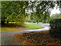
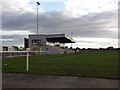
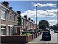
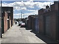
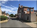
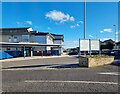
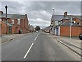
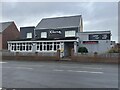
25 photos from this area
Area Information
Key information about the NE63 9EF including its size, population, and administrative classification.
- Area Type
- Postcode
- Area Size
- 1.1 hectares
- Population
- 1506
- Population Density
- 7767 people/km²
House Prices in NE63 9EF
15
Properties
£58,400
Average Sold Price
£18,202
Lowest Price
£95,500
Highest Price
Showing 15 properties
| Address | Type | Beds | Baths | Last Sale Price | Last Sale Date | |
|---|---|---|---|---|---|---|
| 139 Alexandra Road, Ashington, NE63 9EF | house | - | - | £18,202 | Mar 2025 | |
| 109 Alexandra Road, Ashington, NE63 9EF | Terraced | 4 | 2 | £63,500 | Jan 2023 | |
| 141 Alexandra Road, Ashington, NE63 9EF | house | - | - | £70,000 | Sep 2009 | |
| 131 Alexandra Road, Ashington, NE63 9EF | Flat | 2 | 1 | £26,000 | Nov 2006 | |
| 105 Alexandra Road, Ashington, NE63 9EF | Detached | 4 | - | £95,500 | Apr 2006 | |
| 133 Alexandra Road, Ashington, NE63 9EF | Flat | - | - | £80,000 | Nov 2004 | |
| 103 Alexandra Road, Ashington, NE63 9EF | house | 3 | - | £53,000 | Aug 2003 | |
| 125-127 Alexandra Road, Ashington, NE63 9EF | Terraced | 4 | 2 | £61,000 | Jun 2003 | |
| 121 Alexandra Road, Ashington, NE63 9EF | Terraced | 3 | 1 | - | - | |
| 129 Alexandra Road, Ashington, NE63 9EF | Flat | 1 | - | - | - |
Page 1 of 2
Energy Efficiency in NE63 9EF
Amenities
Schools
| Rank | School | Type | Entry gender | Ages |
|---|
Explore more schools in this area
Go to Schools tabDemographics
Household Size
One person
most common
Accommodation Type
Houses
most common
Tenure
44
majority
Ethnic Group
White
most common
Religion
N/A
most common
Household Composition
N/A
most common
Age
47
median
Adults (30-64 years)
most common
Household Deprivation
N/A
with no deprivation
NS-SEC
16
in Lower managerial occupations
Explore more demographic insights in this area
Go to Demographics tabPlanning
Planning Constraints
- Flood RiskPremium
- Ramsar Wetland SitesPremium
- Area of Outstanding Natural BeautyPremium
- Protected Nature ReservePremium
- Protected WoodlandPremium