Area Overview for NE63 8YU
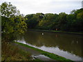
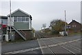
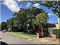
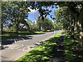
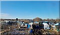
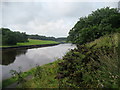
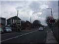
Photos of NE63 8YU


Area Information
Living in NE63 8YU offers a quiet, small-scale residential experience in a cluster of homes that feels distinct from larger urban centres. With a population of 1,287, this postcode area is compact, fostering a close-knit community feel. Daily life here is shaped by its modest size and the practical amenities within reach. The area’s housing stock is predominantly composed of houses, which aligns with the 73% home ownership rate, suggesting a stable, long-term resident base. While not a bustling commercial hub, NE63 8YU benefits from proximity to retail outlets like Co-op Ashington and Morrisons Daily, ensuring everyday needs are met. The median age of 47 and the prevalence of adults aged 30–64 indicate a mature, established population. This is a place where routine is prioritised over spectacle, with residents likely valuing stability and convenience over high-paced living. The absence of major environmental constraints or flood risks adds to its practical appeal, though the moderate crime risk means standard security measures remain advisable.
- Area Type
- Postcode
- Area Size
- Not available
- Population
- 1287
- Population Density
- 3539 people/km²
The property market in NE63 8YU is characterised by a strong emphasis on owner-occupation, with 73% of homes owned by their residents. This contrasts with areas where rental markets dominate, suggesting a focus on long-term residency rather than transient populations. The accommodation type is predominantly houses, which may indicate a preference for single-family homes over flats or apartments. Given the area’s small size and limited development constraints, the housing stock is likely to be relatively uniform, with fewer high-end properties or speculative developments. Buyers should consider that the small population and limited surrounding infrastructure may mean fewer property choices, though the 73% ownership rate implies a steady demand for homes in this cluster. The lack of nearby amenities beyond retail and rail suggests that property values may be more influenced by location and local stability than by proximity to major cities or services.
House Prices in NE63 8YU
No properties found in this postcode.
Energy Efficiency in NE63 8YU
Residents of NE63 8YU have access to a modest but functional range of amenities. The nearby Co-op Ashington, Morrisons Daily, and Heron Hirst provide essential retail and grocery services, reducing the need for long trips to larger centres. Five railway stations within reach offer commuting flexibility, though the exact locations and services are unspecified. The absence of detailed data on leisure or recreational facilities means the area’s lifestyle is likely centred around practicality rather than cultural or entertainment opportunities. For those prioritising convenience over luxury, this cluster of homes offers a straightforward existence with minimal disruption. However, the lack of named parks, dining options, or community hubs suggests that social life may depend heavily on local interactions and nearby towns.
Amenities
Schools
| Rank | School | Type | Entry gender | Ages |
|---|
Explore more schools in this area
Go to Schools tabDemographics
NE63 8YU is predominantly inhabited by adults aged 30–64, with a median age of 47. This suggests a community rooted in middle-aged and older generations, likely with strong ties to local institutions and long-term residency. The 73% home ownership rate indicates a majority of residents are homeowners, which often correlates with a sense of permanence and investment in the area. Accommodation is primarily houses, which may reflect a preference for family-sized or larger properties. The predominant ethnic group is White, though no specific data on diversity or deprivation is provided. The absence of detailed information on household composition or income levels means the area’s socioeconomic profile remains partially opaque. However, the high home ownership and age demographics imply a relatively stable, low-turnover community.
Household Size
Accommodation Type
Tenure
Ethnic Group
Religion
Household Composition
Age
Household Deprivation
NS-SEC
Explore more demographic insights in this area
Go to Demographics tabPlanning
Planning Constraints
- Flood RiskPremium
- Ramsar Wetland SitesPremium
- Area of Outstanding Natural BeautyPremium
- Protected Nature ReservePremium
- Protected WoodlandPremium