Area Overview for NE63 8DH
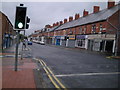
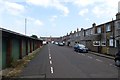
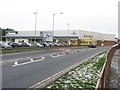
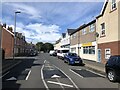
Photos of NE63 8DH

Area Information
Living in NE63 8DH means being part of a tightly knit residential cluster in northeast England. With a population of 2,031 spread across 2.4 hectares, this area is small but densely populated, with 83,398 people per square kilometre. The community here is predominantly adult, with a median age of 47 and most residents falling between 30 and 64 years old. Daily life is shaped by proximity to essential services, including five railway stations and nearby retail hubs like Co-op Ashington and Asda. The area’s compact size means amenities are within walking distance, though its limited size also means housing options are constrained. Home ownership is high at 67%, with houses making up the majority of accommodation. This suggests a stable, long-term resident base, though the small footprint of NE63 8DH means buyers should consider the area’s immediate surroundings for broader options. The postcode is not near major natural sites or protected areas, but its accessibility to rail and retail makes it practical for those prioritising convenience over open space.
- Area Type
- Postcode
- Area Size
- 2.4 hectares
- Population
- 2031
- Population Density
- 2200 people/km²
NE63 8DH is primarily an owner-occupied area, with 67% of residents living in homes they own. The accommodation type is predominantly houses, which aligns with the area’s small size and density. This suggests a market focused on family homes rather than rental properties, though the limited land area means housing stock is constrained. Buyers should consider the proximity to schools and transport, as these are key selling points. The high home ownership rate indicates a community that values long-term investment, but the small postcode area may mean buyers need to look beyond NE63 8DH for larger property choices. The lack of protected natural sites or planning constraints could make development challenging, preserving the existing character of the area. For those prioritising stability and proximity to essential services, this area offers a compact, mature housing market, though its size may limit options for those seeking more space or variety.
House Prices in NE63 8DH
No properties found in this postcode.
Energy Efficiency in NE63 8DH
Residents of NE63 8DH enjoy a lifestyle shaped by proximity to essential amenities. The nearby retail hubs—Co-op Ashington, Heron Hirst, and Asda Ashington—provide access to groceries, clothing, and household goods, reducing the need for long commutes. Five railway stations, including Pegswood, offer easy access to regional travel, while the compact size of the area ensures these services are within walking or cycling distance. Though the postcode itself is small, the surrounding area likely includes parks or green spaces, though specific details are not provided. The presence of schools and retail options suggests a community-oriented environment, where daily needs are met locally. This convenience fosters a self-sufficient lifestyle, ideal for those who value accessibility over expansive open spaces. The character of the area is defined by its practicality, with amenities tailored to a mature, home-owning demographic.
Amenities
Schools
Residents of NE63 8DH have access to three schools within practical reach. Ashington High School is a primary school, serving younger children, while Ashington Academy is an academy with a good Ofsted rating, indicating a strong secondary education option. Buzz Learning Independent Specialist School caters to students with special educational needs. This mix of school types offers flexibility for families, ensuring both mainstream and specialist education is available. The presence of an academy with a good rating suggests a focus on academic standards, which could be appealing to parents prioritising quality education. However, the absence of data on pupil numbers or catchment areas means prospective buyers should verify whether these schools meet their specific needs. The proximity of these schools to the area underscores its appeal for families seeking a balanced lifestyle with access to educational resources.
| Rank | School | Type | Entry gender | Ages |
|---|
Explore more schools in this area
Go to Schools tabDemographics
The community in NE63 8DH is predominantly middle-aged, with a median age of 47 and most residents aged 30–64. Home ownership is strong, with 67% of households owning their homes, reflecting a settled population. The area is largely composed of houses, indicating a focus on family-oriented living rather than apartments or flats. The predominant ethnic group is White, though specific diversity metrics are not provided. The high population density—83,398 people per square kilometre—suggests a compact, possibly multi-generational community. This density may influence local infrastructure, with schools and retail services tailored to a mature demographic. While no data on deprivation is available, the high home ownership rate and presence of nearby amenities suggest a relatively stable quality of life. The age profile implies a community with established careers and families, though the lack of younger residents may affect local dynamics like youth services or social hubs.
Household Size
Accommodation Type
Tenure
Ethnic Group
Religion
Household Composition
Age
Household Deprivation
NS-SEC
Explore more demographic insights in this area
Go to Demographics tabPlanning
Planning Constraints
- Flood RiskPremium
- Ramsar Wetland SitesPremium
- Area of Outstanding Natural BeautyPremium
- Protected Nature ReservePremium
- Protected WoodlandPremium