Area Overview for NE63 0FF
Photos of NE63 0FF
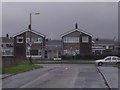


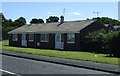
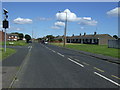
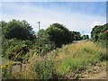
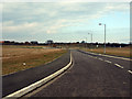

14 photos from this area
Area Information
Key information about the NE63 0FF including its size, population, and administrative classification.
- Area Type
- Postcode
- Area Size
- 1.5 hectares
- Population
- 2033
- Population Density
- 1959 people/km²
House Prices in NE63 0FF
42
Properties
£176,114
Average Sold Price
£11,019
Lowest Price
£254,995
Highest Price
Showing 42 properties
| Address | Type | Beds | Baths | Last Sale Price | Last Sale Date | |
|---|---|---|---|---|---|---|
| 5 Kilbourn Street, Essendene Rise, Ashington, NE63 0FF | Semi-detached | 3 | 2 | £175,000 | May 2024 | |
| 27 Kilbourn Street, Essendene Rise, Ashington, NE63 0FF | house | - | - | £11,019 | Jan 2023 | |
| 13 Kilbourn Street, Essendene Rise, Ashington, NE63 0FF | house | - | - | £250,000 | Mar 2022 | |
| 17 Kilbourn Street, Essendene Rise, Ashington, NE63 0FF | house | - | - | £189,995 | Sep 2020 | |
| 16 Kilbourn Street, Essendene Rise, Ashington, NE63 0FF | house | - | - | £230,845 | Aug 2020 | |
| 21 Kilbourn Street, Essendene Rise, Ashington, NE63 0FF | house | - | - | £145,013 | Mar 2020 | |
| 20 Kilbourn Street, Essendene Rise, Ashington, NE63 0FF | house | - | - | £144,395 | Mar 2020 | |
| 23 Kilbourn Street, Essendene Rise, Ashington, NE63 0FF | house | - | - | £194,995 | Jan 2020 | |
| 36 Kilbourn Street, Essendene Rise, Ashington, NE63 0FF | house | - | - | £172,995 | Jan 2020 | |
| 26 Kilbourn Street, Essendene Rise, Ashington, NE63 0FF | house | - | - | £112,995 | Jan 2020 |
Page 1 of 5
Energy Efficiency in NE63 0FF
Amenities
Schools
| Rank | School | Type | Entry gender | Ages |
|---|
Explore more schools in this area
Go to Schools tabDemographics
Household Size
Two person
most common
Accommodation Type
Houses
most common
Tenure
74
majority
Ethnic Group
White
most common
Religion
N/A
most common
Household Composition
N/A
most common
Age
47
median
Adults (30-64 years)
most common
Household Deprivation
N/A
with no deprivation
NS-SEC
27
in Lower managerial occupations
Explore more demographic insights in this area
Go to Demographics tabPlanning
Planning Constraints
- Flood RiskPremium
- Ramsar Wetland SitesPremium
- Area of Outstanding Natural BeautyPremium
- Protected Nature ReservePremium
- Protected WoodlandPremium