Area Overview for NE61 6AJ
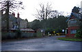
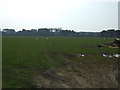
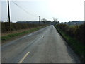
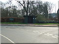
Photos of NE61 6AJ

Area Information
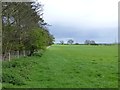
Living in NE61 6AJ offers a quiet residential experience within a small cluster covering 17.3 hectares. This specific postcode area houses a population of 2,680 people, creating a notably low-density environment with just 39 people per square kilometre. The setting is defined by spaciousness and a lack of crowding compared to more urban districts.Residents here enjoy a community where space is abundant, yet essential services remain practically accessible. The area functions as a stable residential hub without the congestion found in larger city centres. For those seeking peace, the scale of this postcode ensures a tranquil daily routine while maintaining reasonable proximity to Morpeth and its surrounding villages. The neighbourhood feels like a established home for long-term residents rather than a fluctuating rental landscape. Life revolves around the steady rhythm of a tight-knit community where neighbours likely know one another well. The physical size of the area contributes to a sense of local ownership and familiarity. You can walk or drive to local hubs without enduring long journeys through heavy traffic. This specific postcode represents a settled environment where the built environment supports a calm, predictable way of living. Prospective buyers here are purchasing a slice of peace within a functional, self-contained residential pocket.
- Area Type
- Postcode
- Area Size
- 17.3 hectares
- Population
- 2680
- Population Density
- 39 people/km²
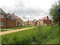
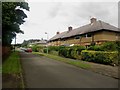
The housing market in NE61 6AJ is characterised by a dominant owner-occupied sector. With 78 per cent of homes held by owners, the area functions primarily as a family settlement rather than a rental hub. This high proportion of owner-occupied properties suggests that most residents have invested in local mortgages and remain for significant periods, contributing to stability. The accommodation type is exclusively houses, meaning you will not find flats or maisonettes within this specific postcode. Prospective buyers looking at homes in NE61 6AJ should expect a traditional residential stock designed for living rather than transient stays. This market structure often correlates with lower rental yields but higher potential for capital growth as owners upgrade or sell into larger homes. The absence of private rental pressure means less noise and disturbance, benefiting both occupants and neighbours who seek a peaceful environment. Small changes to the neighbourhood usually come from owners renovating existing properties rather than developers adding new units. When viewing properties here, you are entering a market driven by homeowner preferences and lifestyle continuity. The data confirms that this is a place where families settle and stay.
House Prices in NE61 6AJ
Showing 3 properties
| Address | Type | Beds | Baths | Last Sale Price | Last Sale Date | |
|---|---|---|---|---|---|---|
| Well Hill Opencast Site, Bets Lane, Morpeth, NE61 6AJ | Industrial | - | - | - | - | |
| Well Hill Farm, Bets Lane, Morpeth, NE61 6AJ | Semi-detached | - | - | - | - | |
| Well Hill Farm Cottage, Bets Lane, Morpeth, NE61 6AJ | Semi-detached | - | - | - | - |
Energy Efficiency in NE61 6AJ
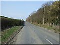
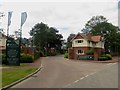
Daily life in NE61 6AJ benefits from several amenities within practical reach. Retail options include Co-op Morpeth, Sainsburys Morpeth, and Iceland Morpeth, providing essential grocery and household shopping needs. Residents can access these stores without needing to travel far, ensuring convenience for daily errands. Transport links are equally accessible, with five railway stations noted nearby, including Morpeth Railway Station, Pegswood Railway Station, and Railway Station. This combination of retail and rail access creates a balanced lifestyle where you can live quietly yet remain connected to broader opportunities. Shop local without sacrificing convenience or quality selection. The availability of multiple transport hubs allows for flexible commuting to Newcastle or other regional centres. Life here blends the ease of home living with the accessibility of town amenities. You do not need to compromise between a suburban retreat and easy transport links. The practical proximity of these venues supports a comfortable routine for working adults and families alike.
Amenities
Schools
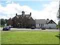
Families living in NE61 6AJ have access to two primary schools with consistent quality ratings. Stannington First School operates as a primary institution and holds a good Ofsted rating. Whalton Church of England Aided Primary School also carries a good Ofsted rating, offering a second option for local children. Both schools fall under the primary category, serving children from early years through a key stage of their education. The concentration of good-rated primary schools suggests a solid educational foundation for young residents. While there are no secondary schools listed within the immediate data for this specific postcode, the presence of two well-rated primaries indicates that local families value education. The proximity of these facilities means parents can rely on institutions that meet national standards. For those concerned about schooling, the neighbourhood provides a clear starting point with verified quality across the board. The education landscape is straightforward, focusing on primary level provision that feeds into the wider regional system.
| Rank | School | Type | Entry gender | Ages |
|---|
Explore more schools in this area
Go to Schools tabDemographics
The community within NE61 6AJ reflects the life stage of settled families and long-term residents. The population data shows a median age of 47 years, with adults aged between 30 and 64 making up the majority of inhabitants. This age profile indicates a neighbourhood that has attracted buyers over an extended period rather than transient renters. Only 22 per cent of the population falls outside this broad adult bracket, suggesting the area is not dominated by young professionals or elderly care demographics. Property ownership defines the social fabric of the area, with 78 per cent of households classified as owner-occupied. This high level of tenure signals financial stability and a strong desire to put down roots. The remaining 22 per cent likely comprises private landlords or those still on the ladder towards purchase. Almost exclusively, the accommodation type consists of houses, reinforcing the character of a traditional family neighbourhood. The predominant ethnic group is White, which mirrors the historic development patterns typical of this region of northern England. There is no evidence of rapid demographic shifts or new development that would alter this established composition. The demographic picture paints a scene of maturity and continuity.
Household Size
Accommodation Type
Tenure
Ethnic Group
Religion
Household Composition
Age
Household Deprivation
NS-SEC
Explore more demographic insights in this area
Go to Demographics tabPlanning
Planning Constraints
- Flood RiskPremium
- Ramsar Wetland SitesPremium
- Area of Outstanding Natural BeautyPremium
- Protected Nature ReservePremium
- Protected WoodlandPremium