Area Overview for NE61 3JL
Photos of NE61 3JL
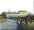
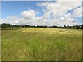
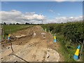
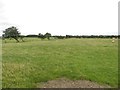
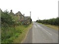
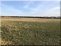

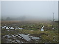
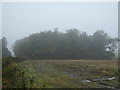
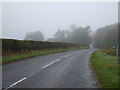

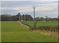
18 photos from this area
Area Information
Key information about the NE61 3JL including its size, population, and administrative classification.
- Area Type
- Postcode
- Area Size
- 16.1 hectares
- Population
- 1747
- Population Density
- 49 people/km²
House Prices in NE61 3JL
32
Properties
£419,382
Average Sold Price
£60,000
Lowest Price
£735,000
Highest Price
Showing 32 properties
| Address | Type | Beds | Baths | Last Sale Price | Last Sale Date | |
|---|---|---|---|---|---|---|
| Hunters Lodge, C 144 Fairmoor Village, Fairmoor, Morpeth, NE61 3JL | Detached | - | - | £735,000 | Feb 2025 | |
| Gayton Ville, Fairmoor, Morpeth, NE61 3JL | Bungalow | 3 | 2 | £505,000 | Sep 2024 | |
| Tanglewood, C 144 Fairmoor Village, Fairmoor, Morpeth, NE61 3JL | Bungalow | 4 | 3 | £545,000 | Aug 2022 | |
| The Gables, Fairmoor, Morpeth, NE61 3JL | Bungalow | 4 | 3 | £450,000 | Nov 2019 | |
| Apuldram, C 144 Fairmoor Village, Fairmoor, Morpeth, NE61 3JL | Bungalow | 4 | 2 | £600,000 | Sep 2019 | |
| Hepstrother, C 144 Fairmoor Village, Fairmoor, Morpeth, NE61 3JL | Bungalow | - | - | £537,000 | Oct 2018 | |
| Longacre, Fairmoor, Morpeth, NE61 3JL | Detached | 5 | 3 | £498,500 | Jul 2017 | |
| Briar Bea, C 144 Fairmoor Village, Fairmoor, Morpeth, NE61 3JL | Detached | - | - | £680,000 | Nov 2016 | |
| Wilarn, Fairmoor, Morpeth, NE61 3JL | Bungalow | 3 | 2 | £375,000 | Dec 2013 | |
| South Perrstain, Fairmoor, Morpeth, NE61 3JL | Semi-detached | 4 | 3 | £280,000 | Dec 2010 |
Page 1 of 4
Energy Efficiency in NE61 3JL
Amenities
Schools
| Rank | School | Type | Entry gender | Ages |
|---|
Explore more schools in this area
Go to Schools tabDemographics
Household Size
Two person
most common
Accommodation Type
Houses
most common
Tenure
77
majority
Ethnic Group
White
most common
Religion
N/A
most common
Household Composition
N/A
most common
Age
47
median
Adults (30-64 years)
most common
Household Deprivation
N/A
with no deprivation
NS-SEC
45
in Lower managerial occupations
Explore more demographic insights in this area
Go to Demographics tabPlanning
Planning Constraints
- Flood RiskPremium
- Ramsar Wetland SitesPremium
- Area of Outstanding Natural BeautyPremium
- Protected Nature ReservePremium
- Protected WoodlandPremium