Area Overview for NE6 5RR
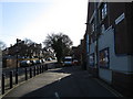
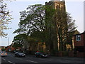
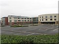
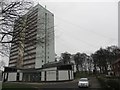
Photos of NE6 5RR


Area Information
Living in NE6 5RR offers a compact, residential experience with a population of 1,584 spread across a small cluster of homes. This area is characterised by a mature demographic, with a median age of 47 and a majority of residents aged 30–64. The community is largely owner-occupied, with 84% of homes owned by residents, suggesting a stable, long-term presence. Daily life here is shaped by proximity to essential services and transport links. The area’s low flood risk and absence of environmental constraints like protected woodlands or Ramsar sites mean residents face minimal natural hazards. While the population is small, the area is well-connected to Newcastle’s infrastructure, including retail hubs like Tesco and Sainsburys, and multiple rail and metro stations. This makes NE6 5RR a practical choice for those prioritising convenience without compromising on safety or accessibility.
- Area Type
- Postcode
- Area Size
- Not available
- Population
- 1584
- Population Density
- 5895 people/km²
NE6 5RR is a predominantly owner-occupied area, with 84% of homes owned by residents rather than rented. This suggests a market where long-term residency is common, and property values may reflect the stability of the community. The accommodation type is primarily houses, which are more prevalent than flats or apartments in this postcode. This housing stock likely appeals to families or individuals seeking larger living spaces. Given the small size of the area, the property market is likely limited to a few homes, meaning buyers may need to consider nearby zones for more options. The high home ownership rate indicates a low rental market, which could mean fewer short-term lets but a stronger sense of community among residents.
House Prices in NE6 5RR
No properties found in this postcode.
Energy Efficiency in NE6 5RR
Residents of NE6 5RR have access to a range of amenities within practical reach. Local retail options include major supermarkets like Tesco, Sainsburys, and Co-op, ensuring everyday shopping needs are met. The area’s proximity to metro stations such as Chillingham Road and Byker, along with rail stops like Dunston and Manors, facilitates easy travel to Newcastle’s business and cultural hubs. Ferry terminals in Newcastle and South Shields provide connections to nearby towns, while Newcastle Airport offers regional and international flight access. These transport links, combined with retail and dining options, create a lifestyle that balances convenience with connectivity. The presence of multiple transport modes suggests a community that is well-served for both daily errands and broader mobility needs.
Amenities
Schools
| Rank | School | Type | Entry gender | Ages |
|---|
Explore more schools in this area
Go to Schools tabDemographics
The community in NE6 5RR is predominantly composed of adults aged 30–64, with a median age of 47. This suggests a mature, established population, likely with families or long-term residents. Home ownership is high, at 84%, indicating a strong sense of local investment. The area is primarily composed of houses, reflecting a more traditional housing stock compared to flats or apartments. The predominant ethnic group is White, though specific data on diversity is not provided. The age profile and ownership rates suggest a community focused on stability, with fewer young families or transient populations. The absence of detailed deprivation data means it is unclear how economic factors influence quality of life, but the high home ownership rate implies a generally secure financial environment for residents.
Household Size
Accommodation Type
Tenure
Ethnic Group
Religion
Household Composition
Age
Household Deprivation
NS-SEC
Explore more demographic insights in this area
Go to Demographics tabPlanning
Planning Constraints
- Flood RiskPremium
- Ramsar Wetland SitesPremium
- Area of Outstanding Natural BeautyPremium
- Protected Nature ReservePremium
- Protected WoodlandPremium