Area Overview for NE6 4SQ
Photos of NE6 4SQ
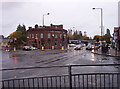
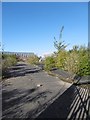
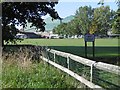
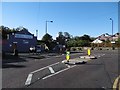

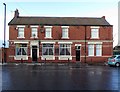


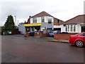
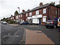
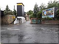
29 photos from this area
Area Information
Key information about the NE6 4SQ including its size, population, and administrative classification.
- Area Type
- Postcode
- Area Size
- 7803 m²
- Population
- 1415
- Population Density
- 6037 people/km²
House Prices in NE6 4SQ
15
Properties
£161,760
Average Sold Price
£47,950
Lowest Price
£260,000
Highest Price
Showing 15 properties
| Address | Type | Beds | Baths | Last Sale Price | Last Sale Date | |
|---|---|---|---|---|---|---|
| 1020 Shields Road, Byker, Newcastle Upon Tyne, NE6 4SQ | Semi-detached | 3 | 2 | £245,000 | Jun 2024 | |
| 1024 Shields Road, Byker, Newcastle Upon Tyne, NE6 4SQ | Semi-detached | 3 | 1 | £260,000 | Jan 2023 | |
| 1004 Shields Road, Byker, Newcastle Upon Tyne, NE6 4SQ | Semi-detached | 3 | 1 | £160,000 | Dec 2021 | |
| 1022 Shields Road, Byker, Newcastle Upon Tyne, NE6 4SQ | Semi-detached | 3 | 2 | £183,000 | Apr 2021 | |
| 1006 Shields Road, Byker, Newcastle Upon Tyne, NE6 4SQ | Semi-detached | - | - | £144,367 | Nov 2005 | |
| 1002A Shields Road, Byker, Newcastle Upon Tyne, NE6 4SQ | Flat | - | - | £92,000 | Aug 2002 | |
| 1012 Shields Road, Byker, Newcastle Upon Tyne, NE6 4SQ | Terraced | - | - | £47,950 | Mar 2000 | |
| 1008 Shields Road, Byker, Newcastle Upon Tyne, NE6 4SQ | Semi-detached | 3 | - | - | - | |
| 1014 Shields Road, Byker, Newcastle Upon Tyne, NE6 4SQ | Terraced | - | - | - | - | |
| 1016 Shields Road, Byker, Newcastle Upon Tyne, NE6 4SQ | Terraced | - | - | - | - |
Page 1 of 2
Energy Efficiency in NE6 4SQ
Amenities
Schools
| Rank | School | Type | Entry gender | Ages |
|---|
Explore more schools in this area
Go to Schools tabDemographics
Household Size
Two person
most common
Accommodation Type
Houses
most common
Tenure
85
majority
Ethnic Group
White
most common
Religion
N/A
most common
Household Composition
N/A
most common
Age
47
median
Adults (30-64 years)
most common
Household Deprivation
N/A
with no deprivation
NS-SEC
34
in Lower managerial occupations
Explore more demographic insights in this area
Go to Demographics tabPlanning
Planning Constraints
- Flood RiskPremium
- Ramsar Wetland SitesPremium
- Area of Outstanding Natural BeautyPremium
- Protected Nature ReservePremium
- Protected WoodlandPremium