Area Overview for NE6 4PY
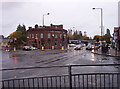
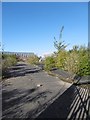
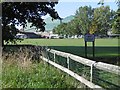
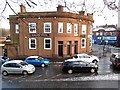
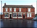
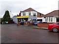
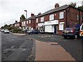
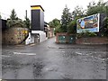
Photos of NE6 4PY


Area Information
NE6 4PY is a small, tightly knit residential postcode in England, home to 1,372 people. This area is defined by its compact size and the presence of family-oriented housing, with 82% of properties owned by residents rather than rented. The median age of 47 suggests a stable community, with most residents falling between 30 and 64 years old. Daily life here is shaped by proximity to essential services, including schools, retail, and transport links. The area’s character is rooted in its modest scale, offering a quieter alternative to larger urban centres. Residents benefit from nearby amenities such as the Walkergate Early Years Centre and Benfield School, while the surrounding infrastructure ensures practical connectivity. Though small, NE6 4PY provides a balance of residential comfort and access to broader networks, making it appealing for those seeking a settled, community-focused lifestyle.
- Area Type
- Postcode
- Area Size
- Not available
- Population
- 1372
- Population Density
- 2509 people/km²
NE6 4PY is primarily an owner-occupied area, with 82% of homes owned by residents. The housing stock is dominated by houses, which are more common than flats or other property types. This suggests a community of families and individuals seeking stable, long-term residences. The small size of the postcode means the housing market is limited in scale, with properties likely to be characterful and well-maintained. Buyers should consider the proximity to amenities such as schools and transport, which enhance the area’s appeal. The predominance of owner-occupied homes indicates a lack of rental demand, which could mean fewer short-term lettings but a stronger sense of community. For those prioritising property value and security, the area’s low crime rate and environmental safety further support its attractiveness.
House Prices in NE6 4PY
No properties found in this postcode.
Energy Efficiency in NE6 4PY
Living in NE6 4PY offers access to a variety of amenities that cater to daily life. The area is within walking distance of five metro stations, including Walkergate and Chillingham Road, providing easy access to public transport. Retail options are plentiful, with stores such as Lidl Walker, M&S Byker, and Sainsburys Newcastle available for groceries and shopping. For travel beyond the local area, five rail stations, including Manors Railway Station, connect residents to broader networks. Ferry terminals at Newcastle International and South Shields add further mobility. The presence of multiple retail, transport, and leisure hubs ensures a convenient lifestyle, with amenities clustered to meet practical needs without requiring long commutes.
Amenities
Schools
Residents of NE6 4PY have access to a range of educational institutions. The Walkergate Early Years Centre provides nursery care, while Benfield School offers primary education. For specialist needs, Newcastle Bridges School caters to students with special educational requirements. Benfield School also operates as an academy with an Ofsted rating of satisfactory, which reflects its adequacy in meeting educational standards. The mix of school types ensures families can find options that align with their children’s needs, from early years care to primary education and specialist support. While no data on secondary schools is provided, the presence of multiple school types within the area suggests a commitment to educational diversity. Parents should consider the Ofsted rating and the specific focus of each institution when evaluating the area.
| Rank | School | Type | Entry gender | Ages |
|---|
Explore more schools in this area
Go to Schools tabDemographics
The population of NE6 4PY is 1,372, with a median age of 47, indicating a mature demographic. The majority of residents fall within the 30-64 age range, suggesting a community of established professionals and families. Home ownership is high, at 82%, reflecting a preference for long-term residency over rental properties. The area is predominantly composed of houses, which aligns with the age profile of its occupants, who may prioritise space and stability. The predominant ethnic group is White, though no data on diversity beyond this is provided. The absence of specific deprivation statistics means the quality of life is inferred from factors like safety and infrastructure. With low crime rates and minimal environmental constraints, the area supports a lifestyle focused on comfort and practicality.
Household Size
Accommodation Type
Tenure
Ethnic Group
Religion
Household Composition
Age
Household Deprivation
NS-SEC
Explore more demographic insights in this area
Go to Demographics tabPlanning
Planning Constraints
- Flood RiskPremium
- Ramsar Wetland SitesPremium
- Area of Outstanding Natural BeautyPremium
- Protected Nature ReservePremium
- Protected WoodlandPremium