Area Overview for NE6 4NE
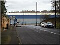
Photos of NE6 4NE


Area Information
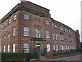
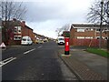
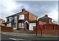
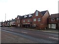
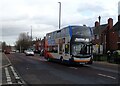
NE6 4NE is a small, tightly knit residential postcode area in England, home to just 1401 people. Its compact size means it’s a quiet, community-focused neighbourhood, with a population skewed towards adults aged 30-64. The area is characterised by its modest housing stock, predominantly owner-occupied properties, though the 24% home ownership rate suggests a significant proportion of residents rent. Despite its small footprint, NE6 4NE offers practical access to essential services, including retail hubs like Heron Church Walk Centre and Asda Hebburn, as well as transport links to nearby towns via metro, rail, and ferry routes. Broadband connectivity is excellent, with a score of 100, though mobile coverage, while strong at 85, may occasionally struggle in more remote pockets. The area’s proximity to schools like West Walker Primary School makes it appealing for families, though the absence of secondary schools nearby means older children may need to commute. For those prioritising safety, the low flood risk and lack of protected natural sites are positives, though the critical crime risk rating demands attention. NE6 4NE is not for the faint-hearted—it’s a place where convenience and challenge coexist.
- Area Type
- Postcode
- Area Size
- Not available
- Population
- 1401
- Population Density
- Not available
NE6 4NE’s property market is defined by its 24% home ownership rate, which is notably low. This suggests that the area is not a strong market for owner-occupiers but rather a rental-focused zone. The accommodation type is primarily houses, though the data does not specify the proportion of detached, semi-detached, or terraced homes. Given the small population and limited housing stock, the area likely has few properties available for sale, making it a niche market for buyers. The low home ownership rate may indicate economic factors such as affordability challenges or a preference for renting among residents. For those seeking investment, the limited supply could mean competition is fierce, though the area’s proximity to transport links and amenities may offset this. Buyers should consider the transient nature of the market and the potential for higher rental yields. However, the lack of detailed property listings means this remains speculative.
House Prices in NE6 4NE
No properties found in this postcode.
Energy Efficiency in NE6 4NE
Daily life in NE6 4NE is shaped by its modest but functional amenities. The area’s retail offerings include five shops, such as Heron Church Walk Centre and Aldi Glen, providing access to groceries, household goods, and general retail. While there are no large supermarkets listed, the proximity to Asda Hebburn ensures residents can meet their bulk shopping needs without long journeys. Transport options are varied, with metro, rail, and ferry services enabling easy travel to nearby towns like Wallsend and South Shields. The presence of five rail stations, including Heworth and Manors, adds convenience for commuters. For leisure, the area lacks detailed information on parks or recreational spaces, but the absence of protected natural sites suggests open areas may be limited. The community’s character is defined by its practicality, with amenities prioritising accessibility over luxury. Residents may find the area ideal for those who value convenience over sprawling green spaces.
Amenities
Schools
The nearest school to NE6 4NE is West Walker Primary School, which serves the local community. The data lists this school twice, but it is the only educational institution mentioned. As a primary school, it caters to children aged 4-11, though no Ofsted rating is provided. Families with young children may find this school convenient, but the absence of secondary schools in the immediate vicinity means older students would need to travel to nearby towns. The lack of data on school performance or capacity means it’s unclear whether the school meets the needs of the area’s population. With a median age of 47 in the neighbourhood, the demand for primary education may be limited compared to areas with younger demographics. Prospective buyers with school-aged children should investigate further to confirm whether West Walker Primary School aligns with their needs.
| Rank | School | Type | Entry gender | Ages |
|---|
Explore more schools in this area
Go to Schools tabDemographics
The population of NE6 4NE is 1401, with a median age of 47, reflecting a community dominated by adults aged 30-64. This suggests a stable, mature demographic with limited presence of younger families or retirees. Home ownership is low at 24%, indicating that most residents are renters, which may contribute to a transient population. The area’s accommodation is primarily houses, though the exact number of flats or terraced homes is unspecified. The predominant ethnic group is White, with no data on other demographics. The low home ownership rate may impact community cohesion, as renters often move frequently. However, the absence of deprivation data means it’s unclear how this affects quality of life. The age profile suggests a workforce-oriented area, with fewer young children to cater for, though the presence of West Walker Primary School hints at some family households. Overall, NE6 4NE is a middle-aged, largely working-age community with limited diversity in both housing and population.
Household Size
Accommodation Type
Tenure
Ethnic Group
Religion
Household Composition
Age
Household Deprivation
NS-SEC
Explore more demographic insights in this area
Go to Demographics tabPlanning
Planning Constraints
- Flood RiskPremium
- Ramsar Wetland SitesPremium
- Area of Outstanding Natural BeautyPremium
- Protected Nature ReservePremium
- Protected WoodlandPremium