Area Overview for NE6 4JL
Photos of NE6 4JL
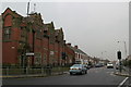
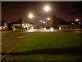

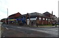
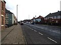
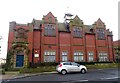
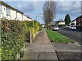
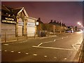
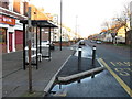
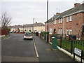
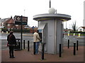
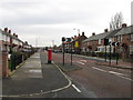
23 photos from this area
Area Information
Key information about the NE6 4JL including its size, population, and administrative classification.
- Area Type
- Postcode
- Area Size
- 4548 m²
- Population
- 1265
- Population Density
- 278143 people/km²
House Prices in NE6 4JL
31
Properties
£72,410
Average Sold Price
£25,000
Lowest Price
£115,000
Highest Price
Showing 31 properties
| Address | Type | Beds | Baths | Last Sale Price | Last Sale Date | |
|---|---|---|---|---|---|---|
| 655 Welbeck Road, Walker, Newcastle Upon Tyne, NE6 4JL | Maisonette | 3 | 1 | £108,000 | Aug 2024 | |
| 635 Welbeck Road, Walker, Newcastle Upon Tyne, NE6 4JL | Flat | - | - | £93,466 | Jun 2024 | |
| 641 Welbeck Road, Walker, Newcastle Upon Tyne, NE6 4JL | Flat | - | - | £72,500 | Apr 2023 | |
| 691 Welbeck Road, Walker, Newcastle Upon Tyne, NE6 4JL | Flat | - | - | £90,500 | Feb 2022 | |
| 677 Welbeck Road, Walker, Newcastle Upon Tyne, NE6 4JL | Flat | - | - | £55,000 | Apr 2021 | |
| 687 Welbeck Road, Walker, Newcastle Upon Tyne, NE6 4JL | Flat | - | - | £91,000 | Nov 2019 | |
| 647 Welbeck Road, Walker, Newcastle Upon Tyne, NE6 4JL | Maisonette | 3 | 1 | £65,000 | Sep 2019 | |
| 649 Welbeck Road, Walker, Newcastle Upon Tyne, NE6 4JL | Flat | - | - | £55,000 | Sep 2019 | |
| 661 Welbeck Road, Walker, Newcastle Upon Tyne, NE6 4JL | Flat | - | - | £65,000 | Aug 2018 | |
| 673 Welbeck Road, Walker, Newcastle Upon Tyne, NE6 4JL | Flat | - | - | £62,500 | Apr 2018 |
Page 1 of 4
Energy Efficiency in NE6 4JL
Amenities
Schools
| Rank | School | Type | Entry gender | Ages |
|---|
Explore more schools in this area
Go to Schools tabDemographics
Household Size
One person
most common
Accommodation Type
Houses
most common
Tenure
55
majority
Ethnic Group
White
most common
Religion
N/A
most common
Household Composition
N/A
most common
Age
47
median
Adults (30-64 years)
most common
Household Deprivation
N/A
with no deprivation
NS-SEC
20
in Lower managerial occupations
Explore more demographic insights in this area
Go to Demographics tabPlanning
Planning Constraints
- Flood RiskPremium
- Ramsar Wetland SitesPremium
- Area of Outstanding Natural BeautyPremium
- Protected Nature ReservePremium
- Protected WoodlandPremium