Area Overview for NE6 4BR
Photos of NE6 4BR
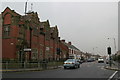
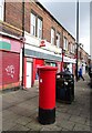
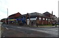
23 photos from this area
Area Information
Key information about the NE6 4BR including its size, population, and administrative classification.
- Area Type
- Postcode
- Area Size
- 2.0 hectares
- Population
- 1432
- Population Density
- 4443 people/km²
House Prices in NE6 4BR
41
Properties
£91,615
Average Sold Price
£66,500
Lowest Price
£114,000
Highest Price
Showing 41 properties
| Address | Type | Beds | Baths | Last Sale Price | Last Sale Date | |
|---|---|---|---|---|---|---|
| 50 Finsbury Avenue, Walker, Newcastle Upon Tyne, NE6 4BR | Semi-detached | 3 | 1 | £91,500 | Feb 2020 | |
| 74 Finsbury Avenue, Walker, Newcastle Upon Tyne, NE6 4BR | house | 3 | 1 | £114,000 | Feb 2020 | |
| 76 Finsbury Avenue, Walker, Newcastle Upon Tyne, NE6 4BR | Semi-detached | 3 | 1 | £105,000 | Dec 2018 | |
| 49 Finsbury Avenue, Walker, Newcastle Upon Tyne, NE6 4BR | Terraced | 2 | - | £74,690 | May 2016 | |
| 52 Finsbury Avenue, Walker, Newcastle Upon Tyne, NE6 4BR | house | 3 | 1 | £98,000 | Feb 2005 | |
| 69 Finsbury Avenue, Walker, Newcastle Upon Tyne, NE6 4BR | Terraced | - | - | £66,500 | Mar 2004 | |
| 43 Finsbury Avenue, Walker, Newcastle Upon Tyne, NE6 4BR | house | - | - | - | - | |
| 67 Finsbury Avenue, Walker, Newcastle Upon Tyne, NE6 4BR | house | - | - | - | - | |
| 71 Finsbury Avenue, Walker, Newcastle Upon Tyne, NE6 4BR | Terraced | - | - | - | - | |
| 51 Finsbury Avenue, Walker, Newcastle Upon Tyne, NE6 4BR | Terraced | - | - | - | - |
Page 1 of 5
Energy Efficiency in NE6 4BR
Amenities
Schools
| Rank | School | Type | Entry gender | Ages |
|---|
Explore more schools in this area
Go to Schools tabDemographics
Household Size
One person
most common
Accommodation Type
Houses
most common
Tenure
59
majority
Ethnic Group
White
most common
Religion
N/A
most common
Household Composition
N/A
most common
Age
47
median
Adults (30-64 years)
most common
Household Deprivation
N/A
with no deprivation
NS-SEC
21
in Lower managerial occupations
Explore more demographic insights in this area
Go to Demographics tabPlanning
Planning Constraints
- Flood RiskPremium
- Ramsar Wetland SitesPremium
- Area of Outstanding Natural BeautyPremium
- Protected Nature ReservePremium
- Protected WoodlandPremium