Area Overview for NE6 4AN
Photos of NE6 4AN
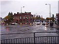
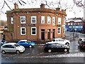
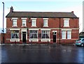


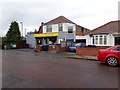
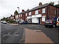
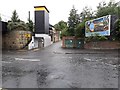
29 photos from this area
Area Information
Key information about the NE6 4AN including its size, population, and administrative classification.
- Area Type
- Postcode
- Area Size
- 2.2 hectares
- Population
- 1827
- Population Density
- 1860 people/km²
House Prices in NE6 4AN
17
Properties
£81,688
Average Sold Price
£33,750
Lowest Price
£112,500
Highest Price
Showing 17 properties
| Address | Type | Beds | Baths | Last Sale Price | Last Sale Date | |
|---|---|---|---|---|---|---|
| 162 Fossway, Walker, Newcastle Upon Tyne, NE6 4AN | house | - | - | £112,500 | Oct 2020 | |
| 170 Fossway, Walker, Newcastle Upon Tyne, NE6 4AN | house | - | - | £80,500 | Apr 2013 | |
| 164 Fossway, Walker, Newcastle Upon Tyne, NE6 4AN | Terraced | - | - | £100,000 | Aug 2006 | |
| 158 Fossway, Walker, Newcastle Upon Tyne, NE6 4AN | Terraced | - | - | £33,750 | Mar 2001 | |
| Chop Ooo, The Valentia, Fossway, Walker, Newcastle Upon Tyne, NE6 4AN | restaurant_cafe | - | - | - | - | |
| 160 Fossway, Walker, Newcastle Upon Tyne, NE6 4AN | house | - | - | - | - | |
| 154 Fossway, Walker, Newcastle Upon Tyne, NE6 4AN | Terraced | - | - | - | - | |
| 172 Fossway, Walker, Newcastle Upon Tyne, NE6 4AN | Terraced | - | - | - | - | |
| 156 Fossway, Walker, Newcastle Upon Tyne, NE6 4AN | Terraced | - | - | - | - | |
| Euromarket Wholesale Ltd (mamma Pasta), 140-142 Fossway, Walker, Newcastle Upon Tyne, NE6 4AN | Flat | - | - | - | - |
Page 1 of 2
Energy Efficiency in NE6 4AN
Amenities
Schools
| Rank | School | Type | Entry gender | Ages |
|---|
Explore more schools in this area
Go to Schools tabDemographics
Household Size
One person
most common
Accommodation Type
Houses
most common
Tenure
42
majority
Ethnic Group
White
most common
Religion
N/A
most common
Household Composition
N/A
most common
Age
47
median
Adults (30-64 years)
most common
Household Deprivation
N/A
with no deprivation
NS-SEC
20
in Lower managerial occupations
Explore more demographic insights in this area
Go to Demographics tabPlanning
Planning Constraints
- Flood RiskPremium
- Ramsar Wetland SitesPremium
- Area of Outstanding Natural BeautyPremium
- Protected Nature ReservePremium
- Protected WoodlandPremium