Area Overview for NE6 3QA
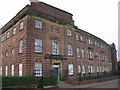
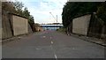
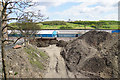
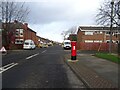
Photos of NE6 3QA


Area Information
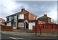
Living in NE6 3QA offers a specific residential experience within a defined area measuring 2,193 square metres. This postcode covers a small residential cluster that currently supports a population of 1,546 people. The density here is calculated at 705,023 people per square kilometre based on the available metrics. Daily life in this location centres on a housing estate model characterised by detached or semi-detached properties. Residents benefit from a structured environment where household numbers are closely managed within a limited footprint. The setting is practical and functional, avoiding the sprawl of larger districts. Instead, you find a concentrated community where neighbours often know each other through shared facilities. The area sits within the broader Walker and Walkergate neighbourhoods, integrating with the wider NE6 crime postcodes. You are part of a group where over half of households are owner-occupied. The location provides direct access to local transport links including bus stops and railway stations. This compact size means amenities are within short walking distances for many families. The area serves as a stable base for those seeking housing without the volume of traffic found in more expansive zones. It is a place where routine activities like shopping or commuting remain predictable due to fixed boundaries.
- Area Type
- Postcode
- Area Size
- 2193 m²
- Population
- 1546
- Population Density
- 705023 people/km²
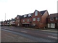
The property market in NE6 3QA is defined by a clear preference for house ownership within a small postcode. The housing stock consists primarily of Houses, which are the dominant accommodation type in this cluster. Only 30% of households own their homes, meaning the majority of residents rely on the rental market. This dynamic characterises the area as a mix of long-term tenants and owner-occupiers. When buying homes in NE6 3QA, you encounter a defined set of properties rather than a diverse range of flats or townhouses. The 1,546 population living in this 2,193 square metre area limits the total volume of available properties. Buyers looking for flats will find few options compared to traditional houses. The market is stable but small, reflecting the compact nature of the residential cluster. You must act quickly if a house becomes available because inventory does not fluctuate greatly. This layout appeals to families seeking single-family homes rather than shared living spaces. The distinction between owned and rented stock remains clear in every street.
House Prices in NE6 3QA
Showing 6 properties
| Address | Type | Beds | Baths | Last Sale Price | Last Sale Date | |
|---|---|---|---|---|---|---|
| 24 Winslow Place, Walker, Newcastle Upon Tyne, NE6 3QA | Terraced | - | - | £34,000 | Aug 1997 | |
| 20 Winslow Place, Walker, Newcastle Upon Tyne, NE6 3QA | Terraced | - | - | - | - | |
| 18 Winslow Place, Walker, Newcastle Upon Tyne, NE6 3QA | Terraced | - | - | - | - | |
| 16 Winslow Place, Walker, Newcastle Upon Tyne, NE6 3QA | house | - | - | - | - | |
| 22 Winslow Place, Walker, Newcastle Upon Tyne, NE6 3QA | house | - | - | - | - | |
| 14 Winslow Place, Walker, Newcastle Upon Tyne, NE6 3QA | Terraced | - | - | - | - |
Energy Efficiency in NE6 3QA
Your lifestyle in NE6 3QA balances convenience with practical access to essential services. Local retail options include Heron Church Walk Centre Walker, Aldi Walker, and Heron Welbeck Road Walker. These venues provide groceries and daily necessities within practical reach of your home. For social visits, Rhodes Street serves as a transport hub and meeting point. You also have access to five metro destinations including Hebburn and Walkergate for leisure trips. Rail connections to Heworth Railway Station, Manors Railway Station, and Brockley Whins Railway Station expand your travel range. Two ferry terminals at Newcastle International and South Shields offer coastal access or international travel. This network of amenities means you rarely need to travel far for routine activities. Shops on nearby high streets supply your household with goods and fresh produce. The area encourages a walkable routine where you can combine shopping with your daily walk. Leisure time is spent locally or during short journeys to nearby towns. The presence of multiple transport modes gives you flexibility for weekends or holidays.
Amenities
Schools
Families looking at schools near NE6 3QA have access to Tyneview Primary School. This institution serves as the primary education provider listed for the area. It is a primary school that caters to younger children in the local cluster. You will find no secondary schools explicitly listed within the immediate data provided for this postcode. The presence of Tyneview Primary School ensures that young children in the area have a dedicated local learning environment. Parents can utilise this school for the early stages of their child's education without commuting further afield. The school list contains this single named entity, indicating that older children may attend schools beyond this immediate postcode boundary. For families with children under eleven years old, Tyneview Primary School represents the nearest educational facility. The school type aligns with the demographic median age of 47, suggesting many residents have young dependents. This educational provision supports the household composition found in NE6 3QA.
| Rank | School | Type | Entry gender | Ages |
|---|
Explore more schools in this area
Go to Schools tabDemographics
The community in NE6 3QA reflects a mature population with a median age of 47 years. Most residents fall into the adult age range between 30 and 64 years, indicating this is an area populated by established adults rather than young families or retirees. You will find that three in ten households own their homes, which translates to a 30% home ownership rate. This figure suggests a significant proportion of residents rent their properties, while the rest seek the stability of ownership. The predominant ethnic group is White, which defines the primary cultural composition of the neighbourhood alongside others. Acton Hall Park and other local green spaces serve the community daily. The age profile implies a need for services catering to working parents and mature adults. You will encounter a mix of parents managing school runs and adults returning to work. The demographic data points to a settled community where long-term residents coexist with newer arrivals. This balance creates a neighbourhood where social patterns remain relatively consistent throughout the seasons. The population density ensures that public services are accessed regularly by a defined group of neighbours.
Household Size
Accommodation Type
Tenure
Ethnic Group
Religion
Household Composition
Age
Household Deprivation
NS-SEC
Explore more demographic insights in this area
Go to Demographics tabPlanning
Planning Constraints
- Flood RiskPremium
- Ramsar Wetland SitesPremium
- Area of Outstanding Natural BeautyPremium
- Protected Nature ReservePremium
- Protected WoodlandPremium