Area Overview for NE6 2PD
Photos of NE6 2PD
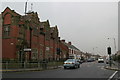
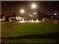

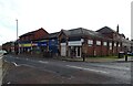
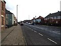
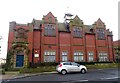
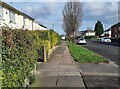
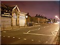
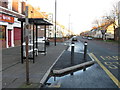
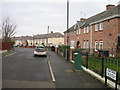
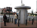
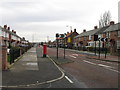
23 photos from this area
Area Information
Key information about the NE6 2PD including its size, population, and administrative classification.
- Area Type
- Postcode
- Area Size
- 1.3 hectares
- Population
- 1817
- Population Density
- 9195 people/km²
House Prices in NE6 2PD
45
Properties
£76,373
Average Sold Price
£17,500
Lowest Price
£110,000
Highest Price
Showing 45 properties
| Address | Type | Beds | Baths | Last Sale Price | Last Sale Date | |
|---|---|---|---|---|---|---|
| 33 Saint Anthonys Road, Walker, Newcastle Upon Tyne, NE6 2PD | Terraced | 3 | 1 | £110,000 | Nov 2022 | |
| 21 Saint Anthonys Road, Walker, Newcastle Upon Tyne, NE6 2PD | house | 3 | - | £100,000 | May 2021 | |
| 8 Saint Anthonys Road, Walker, Newcastle Upon Tyne, NE6 2PD | Terraced | 3 | 1 | £74,000 | Dec 2019 | |
| 50 Saint Anthonys Road, Walker, Newcastle Upon Tyne, NE6 2PD | Terraced | 3 | 1 | £82,500 | Jul 2018 | |
| 23 Saint Anthonys Road, Walker, Newcastle Upon Tyne, NE6 2PD | house | - | - | £85,000 | Jun 2017 | |
| 39 Saint Anthonys Road, Walker, Newcastle Upon Tyne, NE6 2PD | Semi-detached | 3 | 1 | £108,000 | Oct 2014 | |
| 16 Saint Anthonys Road, Walker, Newcastle Upon Tyne, NE6 2PD | house | - | - | £65,100 | Apr 2009 | |
| 43 Saint Anthonys Road, Walker, Newcastle Upon Tyne, NE6 2PD | Terraced | 3 | 1 | £90,000 | Apr 2007 | |
| 40 Saint Anthonys Road, Walker, Newcastle Upon Tyne, NE6 2PD | house | 3 | - | £85,000 | Jul 2006 | |
| 30 Saint Anthonys Road, Walker, Newcastle Upon Tyne, NE6 2PD | Semi-detached | - | - | £23,000 | Sep 1999 |
Page 1 of 5
Energy Efficiency in NE6 2PD
Amenities
Schools
| Rank | School | Type | Entry gender | Ages |
|---|
Explore more schools in this area
Go to Schools tabDemographics
Household Size
Family (3-5 people)
most common
Accommodation Type
Houses
most common
Tenure
19
majority
Ethnic Group
White
most common
Religion
N/A
most common
Household Composition
N/A
most common
Age
47
median
Adults (30-64 years)
most common
Household Deprivation
N/A
with no deprivation
NS-SEC
13
in Lower managerial occupations
Explore more demographic insights in this area
Go to Demographics tabPlanning
Planning Constraints
- Flood RiskPremium
- Ramsar Wetland SitesPremium
- Area of Outstanding Natural BeautyPremium
- Protected Nature ReservePremium
- Protected WoodlandPremium