Area Overview for NE6 2JD
Photos of NE6 2JD
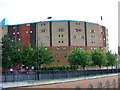

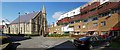
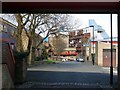
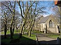
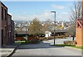
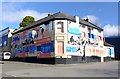
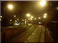
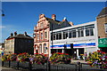
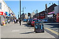
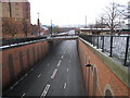
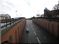
97 photos from this area
Area Information
Key information about the NE6 2JD including its size, population, and administrative classification.
- Area Type
- Postcode
- Area Size
- 9497 m²
- Population
- 1817
- Population Density
- 191324 people/km²
House Prices in NE6 2JD
75
Properties
£51,433
Average Sold Price
£32,000
Lowest Price
£94,000
Highest Price
Showing 75 properties
| Address | Type | Beds | Baths | Last Sale Price | Last Sale Date | |
|---|---|---|---|---|---|---|
| 2 Canterbury Street, Byker, Newcastle Upon Tyne, NE6 2JD | Flat | - | - | £65,000 | Aug 2025 | |
| 44 Canterbury Street, Byker, Newcastle Upon Tyne, NE6 2JD | Flat | 1 | 1 | £46,000 | Aug 2024 | |
| 62 Canterbury Street, Byker, Newcastle Upon Tyne, NE6 2JD | Terraced | 2 | - | £55,000 | Oct 2023 | |
| 53 Canterbury Street, Byker, Newcastle Upon Tyne, NE6 2JD | Flat | - | - | £54,000 | Mar 2022 | |
| 107 Canterbury Street, Byker, Newcastle Upon Tyne, NE6 2JD | Flat | - | - | £32,000 | Aug 2021 | |
| 57 Canterbury Street, Byker, Newcastle Upon Tyne, NE6 2JD | Flat | - | - | £50,000 | Nov 2020 | |
| 49 Canterbury Street, Byker, Newcastle Upon Tyne, NE6 2JD | Flat | - | - | £39,100 | Feb 2020 | |
| 5 Canterbury Street, Byker, Newcastle Upon Tyne, NE6 2JD | Flat | - | - | £35,000 | Jan 2019 | |
| 87 Canterbury Street, Byker, Newcastle Upon Tyne, NE6 2JD | Flat | - | - | £50,000 | Nov 2018 | |
| 11 Canterbury Street, Byker, Newcastle Upon Tyne, NE6 2JD | Flat | - | - | £65,000 | Mar 2018 |
Page 1 of 8
Energy Efficiency in NE6 2JD
Amenities
Schools
| Rank | School | Type | Entry gender | Ages |
|---|
Explore more schools in this area
Go to Schools tabDemographics
Household Size
Family (3-5 people)
most common
Accommodation Type
Houses
most common
Tenure
19
majority
Ethnic Group
White
most common
Religion
N/A
most common
Household Composition
N/A
most common
Age
47
median
Adults (30-64 years)
most common
Household Deprivation
N/A
with no deprivation
NS-SEC
13
in Lower managerial occupations
Explore more demographic insights in this area
Go to Demographics tabPlanning
Planning Constraints
- Flood RiskPremium
- Ramsar Wetland SitesPremium
- Area of Outstanding Natural BeautyPremium
- Protected Nature ReservePremium
- Protected WoodlandPremium