Area Overview for NE5 5DN
Photos of NE5 5DN

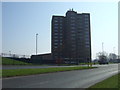
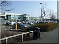
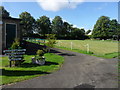
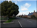
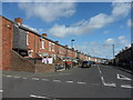

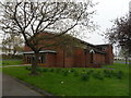
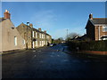
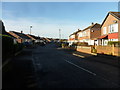

31 photos from this area
Area Information
Key information about the NE5 5DN including its size, population, and administrative classification.
- Area Type
- Postcode
- Area Size
- 4288 m²
- Population
- 1431
- Population Density
- 6437 people/km²
House Prices in NE5 5DN
19
Properties
£88,707
Average Sold Price
£45,500
Lowest Price
£142,500
Highest Price
Showing 19 properties
| Address | Type | Beds | Baths | Last Sale Price | Last Sale Date | |
|---|---|---|---|---|---|---|
| 85 Linbridge Drive, West Denton, Newcastle Upon Tyne, NE5 5DN | Flat | 2 | 1 | £82,000 | Aug 2025 | |
| 71 Linbridge Drive, West Denton, Newcastle Upon Tyne, NE5 5DN | Semi-detached | 3 | 1 | £142,500 | Feb 2023 | |
| 75 Linbridge Drive, West Denton, Newcastle Upon Tyne, NE5 5DN | house | - | - | £109,950 | May 2021 | |
| 79 Linbridge Drive, West Denton, Newcastle Upon Tyne, NE5 5DN | Semi-detached | 3 | 1 | £105,000 | Jul 2020 | |
| 105 Linbridge Drive, West Denton, Newcastle Upon Tyne, NE5 5DN | Flat | 2 | 1 | £45,500 | Sep 2017 | |
| 97 Linbridge Drive, West Denton, Newcastle Upon Tyne, NE5 5DN | Flat | - | - | £60,000 | Nov 2008 | |
| 99 Linbridge Drive, West Denton, Newcastle Upon Tyne, NE5 5DN | Flat | 2 | - | £76,000 | Oct 2006 | |
| 83 Linbridge Drive, West Denton, Newcastle Upon Tyne, NE5 5DN | Semi-detached | - | - | - | - | |
| 91 Linbridge Drive, West Denton, Newcastle Upon Tyne, NE5 5DN | Flat | - | - | - | - | |
| 95 Linbridge Drive, West Denton, Newcastle Upon Tyne, NE5 5DN | Flat | - | - | - | - |
Page 1 of 2
Energy Efficiency in NE5 5DN
Amenities
Schools
| Rank | School | Type | Entry gender | Ages |
|---|
Explore more schools in this area
Go to Schools tabDemographics
Household Size
One person
most common
Accommodation Type
Houses
most common
Tenure
45
majority
Ethnic Group
White
most common
Religion
N/A
most common
Household Composition
N/A
most common
Age
47
median
Adults (30-64 years)
most common
Household Deprivation
N/A
with no deprivation
NS-SEC
21
in Lower managerial occupations
Explore more demographic insights in this area
Go to Demographics tabPlanning
Planning Constraints
- Flood RiskPremium
- Ramsar Wetland SitesPremium
- Area of Outstanding Natural BeautyPremium
- Protected Nature ReservePremium
- Protected WoodlandPremium