Area Overview for NE5 2QD
Photos of NE5 2QD
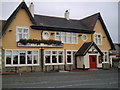


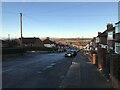
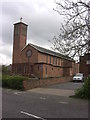
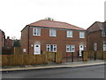
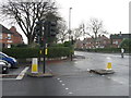
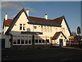
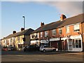

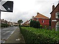
31 photos from this area
Area Information
Key information about the NE5 2QD including its size, population, and administrative classification.
- Area Type
- Postcode
- Area Size
- 6526 m²
- Population
- 1895
- Population Density
- 7792 people/km²
House Prices in NE5 2QD
34
Properties
£88,184
Average Sold Price
£25,000
Lowest Price
£178,000
Highest Price
Showing 34 properties
| Address | Type | Beds | Baths | Last Sale Price | Last Sale Date | |
|---|---|---|---|---|---|---|
| 200 Ovington Grove, Newcastle Upon Tyne, NE5 2QD | Flat | - | - | £178,000 | Nov 2024 | |
| 168 Ovington Grove, Newcastle Upon Tyne, NE5 2QD | Flat | 2 | 1 | £86,000 | May 2024 | |
| 176 Ovington Grove, Newcastle Upon Tyne, NE5 2QD | Flat | - | - | £95,000 | Apr 2024 | |
| 182 Ovington Grove, Newcastle Upon Tyne, NE5 2QD | Flat | - | 1 | £95,000 | Jan 2023 | |
| 196 Ovington Grove, Newcastle Upon Tyne, NE5 2QD | Flat | 2 | 1 | £87,000 | Sep 2022 | |
| 164 Ovington Grove, Newcastle Upon Tyne, NE5 2QD | Flat | 3 | 1 | £96,460 | Oct 2021 | |
| 93 Ovington Grove, Newcastle Upon Tyne, NE5 2QD | Bungalow | 2 | - | £85,000 | Oct 2021 | |
| 174 Ovington Grove, Newcastle Upon Tyne, NE5 2QD | Flat | - | - | £98,000 | Sep 2021 | |
| 184 Ovington Grove, Newcastle Upon Tyne, NE5 2QD | Flat | 3 | 1 | £82,000 | Mar 2021 | |
| 192 Ovington Grove, Newcastle Upon Tyne, NE5 2QD | Flat | - | - | £68,500 | Jul 2020 |
Page 1 of 4
Energy Efficiency in NE5 2QD
Amenities
Schools
| Rank | School | Type | Entry gender | Ages |
|---|
Explore more schools in this area
Go to Schools tabDemographics
Household Size
One person
most common
Accommodation Type
Flats
most common
Tenure
40
majority
Ethnic Group
White
most common
Religion
N/A
most common
Household Composition
N/A
most common
Age
47
median
Adults (30-64 years)
most common
Household Deprivation
N/A
with no deprivation
NS-SEC
22
in Lower managerial occupations
Explore more demographic insights in this area
Go to Demographics tabPlanning
Planning Constraints
- Flood RiskPremium
- Ramsar Wetland SitesPremium
- Area of Outstanding Natural BeautyPremium
- Protected Nature ReservePremium
- Protected WoodlandPremium