Area Overview for NE5 2LE
Photos of NE5 2LE
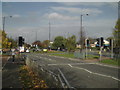
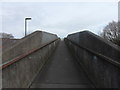
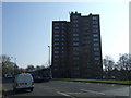
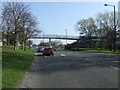
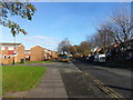
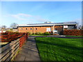
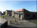
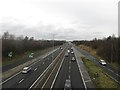
50 photos from this area
Area Information
Key information about the NE5 2LE including its size, population, and administrative classification.
- Area Type
- Postcode
- Area Size
- 4901 m²
- Population
- 2103
- Population Density
- 429126 people/km²
House Prices in NE5 2LE
8
Properties
£136,000
Average Sold Price
£110,000
Lowest Price
£162,000
Highest Price
Showing 8 properties
| Address | Type | Beds | Baths | Last Sale Price | Last Sale Date | |
|---|---|---|---|---|---|---|
| 353 Stamfordham Road, Westerhope, Newcastle Upon Tyne, NE5 2LE | Semi-detached | 3 | 2 | £117,000 | Apr 2022 | |
| 355 Stamfordham Road, Westerhope, Newcastle Upon Tyne, NE5 2LE | house | - | - | £162,000 | Mar 2022 | |
| 343 Stamfordham Road, Westerhope, Newcastle Upon Tyne, NE5 2LE | house | - | - | £160,000 | Nov 2021 | |
| 349 Stamfordham Road, Westerhope, Newcastle Upon Tyne, NE5 2LE | Semi-detached | 3 | 1 | £152,000 | Aug 2020 | |
| 347 Stamfordham Road, Westerhope, Newcastle Upon Tyne, NE5 2LE | house | 3 | - | £115,000 | May 2012 | |
| 345 Stamfordham Road, Westerhope, Newcastle Upon Tyne, NE5 2LE | house | - | - | £110,000 | Mar 2010 | |
| 351 Stamfordham Road, Westerhope, Newcastle Upon Tyne, NE5 2LE | Terraced | - | - | - | - | |
| 341 Stamfordham Road, Westerhope, Newcastle Upon Tyne, NE5 2LE | Semi-detached | - | - | - | - |
Energy Efficiency in NE5 2LE
Amenities
Schools
| Rank | School | Type | Entry gender | Ages |
|---|
Explore more schools in this area
Go to Schools tabDemographics
Household Size
N/A
most common
Accommodation Type
N/A
most common
Tenure
N/A
majority
Ethnic Group
N/A
most common
Religion
N/A
most common
Household Composition
N/A
most common
Age
N/A
median
N/A
most common
Household Deprivation
N/A
with no deprivation
NS-SEC
N/A
in Lower managerial occupations
Explore more demographic insights in this area
Go to Demographics tabPlanning
Planning Constraints
- Flood RiskPremium
- Ramsar Wetland SitesPremium
- Area of Outstanding Natural BeautyPremium
- Protected Nature ReservePremium
- Protected WoodlandPremium