Area Overview for NE5 2LA
Photos of NE5 2LA
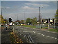

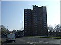

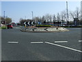
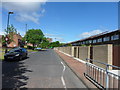

50 photos from this area
Area Information
Key information about the NE5 2LA including its size, population, and administrative classification.
- Area Type
- Postcode
- Area Size
- 6.1 hectares
- Population
- 1388
- Population Density
- 22666 people/km²
House Prices in NE5 2LA
8
Properties
£89,242
Average Sold Price
£3,750
Lowest Price
£162,500
Highest Price
Showing 8 properties
| Address | Type | Beds | Baths | Last Sale Price | Last Sale Date | |
|---|---|---|---|---|---|---|
| 230 Stamfordham Road, Newcastle Upon Tyne, NE5 2LA | Semi-detached | 2 | 2 | £162,500 | May 2025 | |
| 224 Stamfordham Road, Newcastle Upon Tyne, NE5 2LA | house | 3 | - | £132,000 | Dec 2011 | |
| 258 Stamfordham Road, Newcastle Upon Tyne, NE5 2LA | Semi-detached | - | - | £119,950 | Feb 2004 | |
| 254 Stamfordham Road, Newcastle Upon Tyne, NE5 2LA | Semi-detached | 3 | 1 | £73,000 | Dec 2002 | |
| 260 Stamfordham Road, Newcastle Upon Tyne, NE5 2LA | Semi-detached | 3 | 2 | £44,250 | Mar 2001 | |
| 256 Stamfordham Road, Newcastle Upon Tyne, NE5 2LA | Semi-detached | - | - | £3,750 | Apr 1996 | |
| 226 Stamfordham Road, Newcastle Upon Tyne, NE5 2LA | Semi-detached | - | - | - | - | |
| 228 Stamfordham Road, Newcastle Upon Tyne, NE5 2LA | Semi-detached | - | - | - | - |
Energy Efficiency in NE5 2LA
Amenities
Schools
| Rank | School | Type | Entry gender | Ages |
|---|
Explore more schools in this area
Go to Schools tabDemographics
Household Size
Family (3-5 people)
most common
Accommodation Type
Houses
most common
Tenure
46
majority
Ethnic Group
White
most common
Religion
N/A
most common
Household Composition
N/A
most common
Age
47
median
Adults (30-64 years)
most common
Household Deprivation
N/A
with no deprivation
NS-SEC
16
in Lower managerial occupations
Explore more demographic insights in this area
Go to Demographics tabPlanning
Planning Constraints
- Flood RiskPremium
- Ramsar Wetland SitesPremium
- Area of Outstanding Natural BeautyPremium
- Protected Nature ReservePremium
- Protected WoodlandPremium