Area Overview for NE5 2BJ
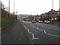
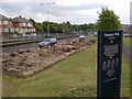
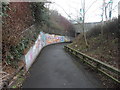
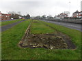
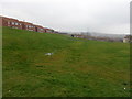
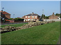
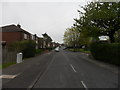
Photos of NE5 2BJ


Area Information
Living in NE5 2BJ means inhabiting a compact, densely populated residential cluster in England. The area covers just 2.6 hectares, yet it houses 1,565 residents, translating to a population density of 59,274 people per square kilometre. This high density suggests a tightly knit community, though the small size means the area is more of a microcosm than a sprawling suburb. The postcode is characterised by a mix of practical living, with flats dominating the accommodation type. Daily life here is shaped by proximity to essential services, including retail, transport hubs, and schools. While the area lacks natural landscapes like AONB or protected woodlands, its strategic location near Newcastle Airport and multiple rail and metro stations ensures connectivity. However, the community’s profile—skewed toward adults aged 30-64 with a median age of 47—hints at a mature, established population. For those considering NE5 2BJ, the challenge lies in balancing the area’s practicality with its limited space, but the availability of nearby amenities may offset the compact footprint.
- Area Type
- Postcode
- Area Size
- 2.6 hectares
- Population
- 1565
- Population Density
- 4410 people/km²
The property market in NE5 2BJ is dominated by flats, with home ownership at 39%, indicating a rental-heavy area. This suggests that most residents are tenants rather than homeowners, which may influence the dynamics of the housing stock. The compact nature of the postcode—covering just 2.6 hectares—means the available properties are likely limited in number and spread across a small footprint. Buyers considering this area should note that the market is not geared toward owner-occupiers but rather those seeking rental accommodation. The prevalence of flats may appeal to those prioritising convenience over space, though the high population density raises questions about overcrowding or the availability of larger properties. For those exploring the immediate surroundings, the property landscape may mirror NE5 2BJ’s characteristics, with similar constraints on housing options.
House Prices in NE5 2BJ
Showing 1 properties
| Address | Type | Beds | Baths | Last Sale Price | Last Sale Date | |
|---|---|---|---|---|---|---|
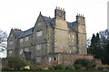
| East Denton Hall, 800 West Road, Newcastle Upon Tyne, NE5 2BJ | Detached | 10 | 4 | £1,310,000 | Sep 2020 |
Energy Efficiency in NE5 2BJ
Daily life in NE5 2BJ is shaped by its proximity to a range of amenities. Retail options include Sainsburys Denton Burn, Morrisons Westerhope, and Iceland Newcastle, providing convenience for grocery shopping. The area’s transport links—five rail stations, three metro stops, and a bus route—make commuting and travel efficient. Residents can access Newcastle Airport with ease, which is a boon for those requiring frequent air travel. While parks or leisure facilities are not explicitly listed, the presence of multiple transport hubs suggests the area is integrated into broader networks of recreation and culture. The combination of retail, transport, and airport access creates a practical lifestyle, though the lack of specific leisure venues means residents may need to venture further for activities like dining or entertainment.
Amenities
Schools
The nearest school to NE5 2BJ is Redewood School, a primary institution. No Ofsted rating is provided, so its performance remains unspecified. The presence of a primary school is a key consideration for families with young children, though the absence of secondary schools in the data means parents may need to look further afield for secondary education. The single school listed suggests that the area’s educational offerings are limited to primary level, which could be a drawback for households requiring a full range of schooling options. Families should investigate additional schools in nearby postcodes to ensure their children’s long-term educational needs are met.
| Rank | School | Type | Entry gender | Ages |
|---|
Explore more schools in this area
Go to Schools tabDemographics
NE5 2BJ’s population is predominantly adults aged 30-64, with a median age of 47. This suggests a community of middle-aged residents, many of whom may be settled in long-term housing or nearing retirement. Home ownership here is relatively low, with only 39% of residents owning their homes. The majority live in flats, a reflection of the area’s small size and likely focus on rental properties. The predominant ethnic group is White, though no specific diversity metrics are provided. The high population density—59,274 people per square kilometre—raises questions about living space per person, but the data does not quantify this. The age profile implies a stable, possibly working-age population, though the absence of data on family structures or deprivation levels means the full picture of quality of life remains incomplete.
Household Size
Accommodation Type
Tenure
Ethnic Group
Religion
Household Composition
Age
Household Deprivation
NS-SEC
Explore more demographic insights in this area
Go to Demographics tabPlanning
Planning Constraints
- Flood RiskPremium
- Ramsar Wetland SitesPremium
- Area of Outstanding Natural BeautyPremium
- Protected Nature ReservePremium
- Protected WoodlandPremium