Area Overview for NE49 0AN
Photos of NE49 0AN
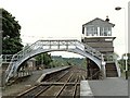
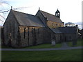
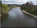
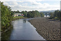

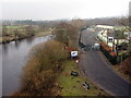
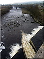
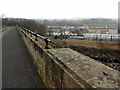
100 photos from this area
Area Information
Key information about the NE49 0AN including its size, population, and administrative classification.
- Area Type
- Postcode
- Area Size
- 2.9 hectares
- Population
- 1085
- Population Density
- 1395 people/km²
House Prices in NE49 0AN
7
Properties
£230,500
Average Sold Price
£201,000
Lowest Price
£260,000
Highest Price
Showing 7 properties
| Address | Type | Beds | Baths | Last Sale Price | Last Sale Date | |
|---|---|---|---|---|---|---|
| Wydoncroft, Wydon Lane, Haltwhistle, NE49 0AN | Bungalow | 3 | 1 | £201,000 | Jul 2025 | |
| The Shieling, Wydon Lane, Haltwhistle, NE49 0AN | Bungalow | 3 | - | £260,000 | Jun 2014 | |
| Lyndale, Wydon Lane, Haltwhistle, NE49 0AN | Detached | - | - | - | - | |
| The Rush, Wydon Lane, Haltwhistle, NE49 0AN | Detached | - | - | - | - | |
| Fairy House, Wydon Lane, Haltwhistle, NE49 0AN | Detached | 4 | 1 | - | - | |
| Rowanrigg, Wydon Lane, Haltwhistle, NE49 0AN | Detached | - | - | - | - | |
| Cobble Stones, Wydon Lane, Haltwhistle, NE49 0AN | Detached | - | - | - | - |
Energy Efficiency in NE49 0AN
Amenities
Schools
| Rank | School | Type | Entry gender | Ages |
|---|
Explore more schools in this area
Go to Schools tabDemographics
Household Size
One person
most common
Accommodation Type
Houses
most common
Tenure
69
majority
Ethnic Group
White
most common
Religion
N/A
most common
Household Composition
N/A
most common
Age
47
median
Adults (30-64 years)
most common
Household Deprivation
N/A
with no deprivation
NS-SEC
18
in Lower managerial occupations
Explore more demographic insights in this area
Go to Demographics tabPlanning
Planning Constraints
- Flood RiskPremium
- Ramsar Wetland SitesPremium
- Area of Outstanding Natural BeautyPremium
- Protected Nature ReservePremium
- Protected WoodlandPremium