Area Overview for NE48 3ET
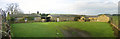
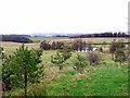
Photos of NE48 3ET


Area Information
Living in NE48 3ET means inhabiting a small, low-density residential cluster in England. With a population of just 1080 people spread across 6 people per square kilometre, the area feels quiet and unspoiled. This is a place where homes are spaced apart, offering privacy and a sense of seclusion. The community is likely tight-knit, with a median age of 47 and most residents falling within the 30-64 age range. Daily life here is shaped by proximity to Haydon Bridge Railway Station and nearby Co-op stores in Haydon and Bellingham. The area’s small size means it’s not heavily developed, with no major infrastructure or urban pressures. For those seeking a peaceful, low-traffic environment, NE48 3ET offers a contrast to busier regions. However, its remoteness may mean fewer amenities within walking distance, requiring reliance on nearby towns for shopping, dining, and leisure. The postcode’s character is defined by its sparse population and the absence of environmental or planning constraints, making it a straightforward, no-frills location.
- Area Type
- Postcode
- Area Size
- Not available
- Population
- 1080
- Population Density
- 6 people/km²
The property market in NE48 3ET is characterised by a 57% home ownership rate, suggesting that nearly half of the area’s housing stock is owner-occupied. The accommodation type is predominantly houses, with no indication of flats or other property types. This implies a focus on single-family homes, which may cater to families or individuals seeking private, spacious living. Given the area’s small size and low population density, the housing stock is likely limited in both quantity and variety. Buyers should consider that the market may be niche, with fewer properties available compared to larger towns. The absence of rental data means it’s unclear whether the area is more geared towards long-term residents or short-term lets. For those seeking a house in a quiet, low-traffic location, NE48 3ET offers a straightforward option, though the limited scale of the area may restrict choices.
House Prices in NE48 3ET
No properties found in this postcode.
Energy Efficiency in NE48 3ET
The lifestyle in NE48 3ET is shaped by its proximity to Haydon Bridge Railway Station and two Co-op stores in Haydon and Bellingham. These amenities provide access to basic shopping and transport links, though the area itself lacks larger retail hubs or leisure facilities. The absence of parks, cafes, or entertainment venues within the postcode means residents must travel to nearby towns for dining, recreation, or social activities. The quiet, low-density environment may appeal to those seeking simplicity, but it also means daily life is centred around essential services. The railway station offers a connection to broader networks, while the Co-ops provide convenience for groceries. Overall, the area’s lifestyle is practical but limited, with a focus on functionality over variety.
Amenities
Schools
The nearest school to NE48 3ET is Wark Church of England Primary School, which serves the local community. The data lists this school twice, but it is the only educational institution mentioned. As a primary school, it caters to children aged 4–11, though no Ofsted rating or performance data is provided. Families with young children may need to travel to nearby towns for secondary education, as no secondary schools are listed. The presence of a single primary school suggests that the area’s educational offerings are limited to this level, which could be a consideration for parents planning long-term. The lack of diversity in school types means that families must rely on this single institution for early education, potentially requiring additional arrangements for older children.
| Rank | School | Type | Entry gender | Ages |
|---|
Explore more schools in this area
Go to Schools tabDemographics
The community in NE48 3ET is predominantly middle-aged, with a median age of 47 and most residents aged between 30 and 64. Home ownership rates stand at 57%, indicating a mix of owner-occupied properties and rentals. The area is largely composed of houses, with no mention of flats or apartments in the data. The predominant ethnic group is White, reflecting a homogenous demographic profile. With a population density of 6 people per square kilometre, the area is sparsely populated, which may contribute to a quieter, less congested lifestyle. The low density also suggests that social interactions are likely to be more informal, with neighbours potentially knowing each other well. However, the absence of detailed data on deprivation or diversity means the quality of life is inferred from the low population density and the lack of environmental restrictions. This profile may appeal to those prioritising space and tranquillity over urban amenities.
Household Size
Accommodation Type
Tenure
Ethnic Group
Religion
Household Composition
Age
Household Deprivation
NS-SEC
Explore more demographic insights in this area
Go to Demographics tabPlanning
Planning Constraints
- Flood RiskPremium
- Ramsar Wetland SitesPremium
- Area of Outstanding Natural BeautyPremium
- Protected Nature ReservePremium
- Protected WoodlandPremium