Area Overview for NE48 2BD
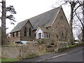
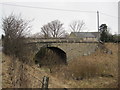
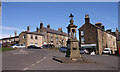
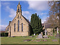
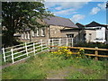
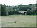
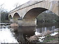
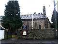
Photos of NE48 2BD
Area Information
Living in NE48 2BD means being part of a small, tightly knit residential cluster in England, where the population of 2,183 spreads across 12 people per square kilometre. This is a quiet, low-density area, ideal for those seeking a slower pace of life. The community is predominantly composed of adults aged 30–64, with a median age of 47, suggesting a mature, stable population. Most residents own their homes, with 62% of properties in private ownership, and the area is characterised by houses rather than flats. NE48 2BD sits near Bellingham Primary School and Bellingham Middle School, both rated good by Ofsted, making it appealing for families. The low crime risk, with a safety score of 77, and minimal environmental constraints, such as no protected woodlands or Ramsar sites, add to its practicality. Daily life here is shaped by proximity to local amenities like Co-op Bellingham, while the area’s small size ensures a close-knit feel. For buyers, NE48 2BD offers a blend of residential tranquillity and essential services, though its limited scale means choices are focused on immediate surroundings.
- Area Type
- Postcode
- Area Size
- Not available
- Population
- 2183
- Population Density
- 12 people/km²
The property market in NE48 2BD is dominated by owner-occupied homes, with 62% of properties in private hands. This contrasts with areas where rental markets prevail, suggesting a community of long-term residents rather than transient tenants. The accommodation type is primarily houses, which aligns with the low population density and the area’s small scale. For buyers, this means a limited inventory of properties, as the cluster is compact and not part of a larger development. The focus on houses rather than flats may appeal to those seeking more space, though the small size of NE48 2BD means buyers must consider nearby areas for additional options. The high home ownership rate also implies strong local ties, with properties likely retaining value due to the area’s stability. However, the lack of commercial or industrial development means property appreciation is tied to residential demand and proximity to essential services like schools and retail.
House Prices in NE48 2BD
No properties found in this postcode.
Energy Efficiency in NE48 2BD
The lifestyle in NE48 2BD is shaped by its small size and limited amenities. The nearest retail option is Co-op Bellingham, providing essential groceries and services. This suggests a basic level of convenience, with residents likely relying on nearby towns for more extensive shopping or dining. The area’s proximity to schools and low population density fosters a quiet, community-oriented environment, where interactions are likely to be local and familiar. Parks or leisure facilities are not explicitly mentioned, though the absence of protected natural sites means open spaces may be limited. The lack of detailed data on leisure options implies that residents may need to travel to larger centres for entertainment or recreation. Despite this, the area’s simplicity and low crime risk contribute to a safe, uncluttered lifestyle. For those valuing privacy and proximity to essential services, NE48 2BD offers a straightforward, no-frills existence.
Amenities
Schools
Residents of NE48 2BD have access to three primary schools within practical reach: Bellingham Primary School, West Woodburn First School, and Bellingham Middle School and Sports College. Both Bellingham Primary and Bellingham Middle School hold Ofsted ratings of ‘good’, indicating a consistent standard of education. West Woodburn First School is listed without an Ofsted rating, though its presence adds to the local school infrastructure. The availability of multiple primary schools suggests a family-friendly environment, with options for parents to choose between institutions. The inclusion of a middle school within the area reduces the need for long commutes for older children, supporting a balanced lifestyle. For families prioritising education, the mix of school types and the quality ratings of two institutions provide reassurance about local provision. The proximity of these schools to NE48 2BD enhances its appeal as a place to raise children, though no secondary schools are mentioned in the data.
| Rank | School | Type | Entry gender | Ages |
|---|
Explore more schools in this area
Go to Schools tabDemographics
NE48 2BD’s population is defined by a median age of 47, with the majority of residents falling within the 30–64 age range. This suggests a community of established adults, likely with families, contributing to a stable and mature demographic. Home ownership is high at 62%, indicating a preference for long-term residency over rental properties. The area is dominated by houses rather than flats, reflecting a traditional housing stock. The predominant ethnic group is White, though no specific data on diversity or deprivation is provided. The low population density of 12 people per square kilometre implies spacious living conditions, with fewer neighbours and a more private lifestyle. For buyers, this demographic profile suggests a community focused on stability and family life, with limited turnover in property ownership. The absence of detailed diversity metrics means the area’s social composition remains largely unexplored in public data, but the existing figures paint a picture of a cohesive, middle-aged population with a strong emphasis on home ownership.
Household Size
Accommodation Type
Tenure
Ethnic Group
Religion
Household Composition
Age
Household Deprivation
NS-SEC
Explore more demographic insights in this area
Go to Demographics tabPlanning
Planning Constraints
- Flood RiskPremium
- Ramsar Wetland SitesPremium
- Area of Outstanding Natural BeautyPremium
- Protected Nature ReservePremium
- Protected WoodlandPremium