Area Overview for NE47 9QZ
Photos of NE47 9QZ


Area Information
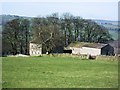
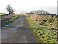
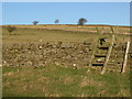
NE47 9QZ is a small, tightly knit residential cluster in England, covering just 1.8 hectares and home to 1,070 residents. With a population density of 244 people per square kilometre, it’s a compact area where daily life unfolds in close proximity to local amenities. The community is predominantly composed of adults aged 30 to 64, with a median age of 47, suggesting a stable, mature demographic. This is a place where homeownership is common — 68% of residents own their homes — and the housing stock is largely made up of houses rather than flats. The area’s small size means it’s easy to navigate on foot or by bike, and its proximity to nearby towns and rail links offers a balance between rural tranquillity and urban accessibility. Living here feels like being part of a close-knit neighbourhood where the pace of life is measured, and community ties are likely strong.
- Area Type
- Postcode
- Area Size
- 1.8 hectares
- Population
- 1070
- Population Density
- 244 people/km²
NE47 9QZ is a predominantly owner-occupied area, with 68% of residents owning their homes. The housing stock is almost exclusively made up of houses, which suggests a focus on family-friendly or semi-detached properties. This contrasts with areas where flats or apartments dominate, and it may indicate a more traditional, low-density residential character. Given the area’s small size, the property market is likely limited to a handful of homes, with limited scope for new developments. Buyers should consider that the proximity to nearby towns and rail stations could offer additional options beyond the immediate postcode. However, the small population and compact footprint mean that the local market is unlikely to have a wide range of properties, making it a niche area for those seeking a quiet, established home.
House Prices in NE47 9QZ
No properties found in this postcode.
Energy Efficiency in NE47 9QZ
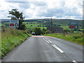
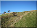
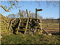
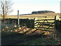
The lifestyle in NE47 9QZ is shaped by its proximity to essential amenities within practical reach. Residents can access three retail outlets, including Allendale Co-operative Society, Co-op Haydon, and Spar, offering everyday shopping needs. The two nearby rail stations — Haydon Bridge and Bardon Mill — provide easy access to regional transport, enabling trips to nearby towns for leisure, work, or services. While the area itself is small, the combination of local shops and rail links ensures that daily life remains convenient. The character of the area is likely rural or semi-rural, with a focus on community-centred living. The availability of these amenities, though limited in scope, supports a self-contained lifestyle, particularly for those who prefer a slower pace of life.
Amenities
Schools
Residents of NE47 9QZ have access to two primary schools: Allendale Primary School, which holds a ‘good’ Ofsted rating, and Allendale Middle School. Both institutions serve the local community, providing education for younger children. The presence of two primary schools suggests that families in the area have options for their children’s early education, though secondary schooling would require travel to nearby towns. The ‘good’ rating at Allendale Primary indicates a school that meets national standards, which could be a key consideration for parents prioritising quality education. However, the absence of secondary schools within the postcode means that families must factor in commuting times or the availability of transport links for older children.
| Rank | School | Type | Entry gender | Ages |
|---|
Explore more schools in this area
Go to Schools tabDemographics
The population of NE47 9QZ is skewed towards adults aged 30 to 64, with a median age of 47. This suggests a community of established professionals, families, and retirees, all contributing to a mature, low-turnover environment. Homeownership is high at 68%, indicating a preference for long-term residency over rental properties. The accommodation type is predominantly houses, which aligns with the area’s character as a residential cluster rather than a high-density development. The predominant ethnic group is White, reflecting the broader demographic trends in the region. With no specific data on deprivation, the area’s stability and home ownership rates imply a generally secure quality of life, though the small population size means limited diversity in household composition or age ranges.
Household Size
Accommodation Type
Tenure
Ethnic Group
Religion
Household Composition
Age
Household Deprivation
NS-SEC
Explore more demographic insights in this area
Go to Demographics tabPlanning
Planning Constraints
- Flood RiskPremium
- Ramsar Wetland SitesPremium
- Area of Outstanding Natural BeautyPremium
- Protected Nature ReservePremium
- Protected WoodlandPremium