Area Overview for NE47 8YZ
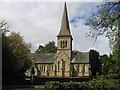
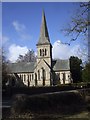
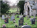
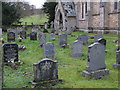
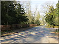
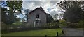
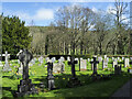
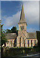
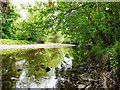
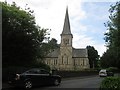
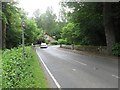
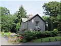
Photos of NE47 8YZ
Area Information
Living in NE47 8YZ means being part of a small, tightly knit residential cluster in north-east England. With a population of just 1002 people spread across a low-density area, this postcode area feels quiet and unassuming. The community is likely characterised by a mix of older and newer properties, reflecting the median age of 47 and the dominance of adult households aged 30–64. Daily life here is shaped by proximity to nearby schools, a rail station, and minimal environmental constraints. The area’s safety profile is strong, with low flood risk and below-average crime rates, making it appealing for families seeking stability. While the broadband score is poor, mobile coverage is good, ensuring basic connectivity for most residents. NE47 8YZ is not a bustling urban hub but a place where neighbours know each other, and the pace of life is slower. Its small size means amenities are limited, but the surrounding areas offer practical access to retail and transport. For buyers prioritising safety, low population density, and a traditional rural feel, this area could be an attractive choice.
- Area Type
- Postcode
- Area Size
- Not available
- Population
- 1002
- Population Density
- 5 people/km²
The property market in NE47 8YZ is defined by a high rate of home ownership (60%) and a predominance of houses over flats or apartments. This suggests a traditional, rural housing stock with larger properties, likely suited to families or individuals seeking space. Given the area’s small size and low population density, the number of available homes is limited, which may make the market competitive for buyers. The focus on owner-occupied properties rather than rental units implies a community where long-term residency is common. However, the lack of specific data on property prices or recent sales means it is difficult to assess whether this is a growing or stagnant market. For buyers, the mix of safety, low crime, and proximity to schools could be strong selling points, though the limited local amenities may require consideration of nearby towns for day-to-day needs.
House Prices in NE47 8YZ
No properties found in this postcode.
Energy Efficiency in NE47 8YZ
The lifestyle in NE47 8YZ is shaped by its small size and limited local amenities. Within practical reach, residents have access to two retail spots: Allendale Co-operative Society and Spar, providing basic shopping needs. The nearest rail station, Bardon Mill Station, offers transport links to nearby towns, though the extent of services is unclear. There is no mention of parks, leisure facilities, or dining options in the data, suggesting that recreational activities may require travel. The area’s character is likely quiet and rural, with a focus on essential services rather than vibrant social hubs. For those prioritising convenience, the proximity to schools and transport may offset the lack of local amenities. However, the absence of detailed information on parks or cultural venues means the area’s appeal depends heavily on its safety, low population density, and proximity to nearby towns.
Amenities
Schools
Residents of NE47 8YZ have access to four primary schools within practical reach, including Herdley Bank First School, Whitfield Church of England Voluntary Aided Primary School, and Whitfield CofE Primary School, which holds a ‘good’ Ofsted rating. The presence of multiple primary schools suggests a focus on early education, though no secondary schools are listed in the data. For families, this means children can attend local schools without long commutes, but parents may need to look further afield for secondary education. The ‘good’ rating at Whitfield CofE Primary School indicates a school with strong performance, though the overall mix of schools is limited to primary levels. This could be a consideration for families planning for long-term education needs, as the area’s small size may restrict options for higher education or specialist provision.
| Rank | School | Type | Entry gender | Ages |
|---|
Explore more schools in this area
Go to Schools tabDemographics
The community in NE47 8YZ is predominantly composed of adults aged 30–64, with a median age of 47. This suggests a mature population, likely with established careers and families. Home ownership is high at 60%, indicating a stable housing market where most residents live in their own homes rather than renting. The accommodation type is primarily houses, which aligns with the area’s low population density and traditional rural character. The predominant ethnic group is White, reflecting a homogenous demographic profile. While no specific deprivation data is provided, the combination of high home ownership and low crime rates suggests a relatively affluent or stable community. The absence of significant diversity metrics means the area may lack the cultural vibrancy found in more cosmopolitan regions. For families, the age profile and safety record could make it a practical choice, though the limited local amenities may require commuting for broader services.
Household Size
Accommodation Type
Tenure
Ethnic Group
Religion
Household Composition
Age
Household Deprivation
NS-SEC
Explore more demographic insights in this area
Go to Demographics tabPlanning
Planning Constraints
- Flood RiskPremium
- Ramsar Wetland SitesPremium
- Area of Outstanding Natural BeautyPremium
- Protected Nature ReservePremium
- Protected WoodlandPremium