Area Overview for NE47 7DL
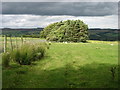
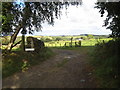
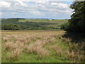
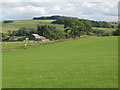
Photos of NE47 7DL

Area Information
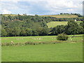
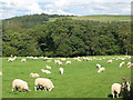
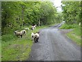
Living in NE47 7DL means being part of a small, low-density residential cluster in England, where the population of 2068 people spreads across 13 people per square kilometre. This area is characterised by a quiet, suburban feel, with homes predominantly occupied by owners. The community is largely composed of adults aged 30–64, reflecting a mature demographic with established roots. Daily life here is shaped by proximity to local amenities and schools, though the area’s size means it is not densely populated. Residents benefit from a mix of rural and semi-urban living, with easy access to nearby rail stations and retail outlets. The low crime risk and absence of environmental constraints make it a stable place to live. However, the limited population density means social interactions are likely to be more community-focused than in larger towns. For those seeking a peaceful, owner-occupied lifestyle with access to essential services, NE47 7DL offers a straightforward, no-frills environment.
- Area Type
- Postcode
- Area Size
- Not available
- Population
- 2068
- Population Density
- 13 people/km²
The property market in NE47 7DL is dominated by owner-occupied homes, with 79% of properties owned by residents rather than rented. This high home ownership rate suggests a community of long-term residents who are less likely to be influenced by short-term rental demand. The accommodation is almost exclusively houses, which is typical of smaller, rural or semi-urban areas where larger plots of land are available. This housing stock implies a more traditional, low-density development pattern, with properties likely to be spacious and well-established. For buyers, the small size of the area means that the housing market is limited, with few new developments. Prospective buyers should consider the proximity to local amenities and schools, as these are key factors in the area’s appeal. The absence of high-rise or apartment blocks also means that properties here are likely to have more garden space and a quieter, more private setting.
House Prices in NE47 7DL
No properties found in this postcode.
Energy Efficiency in NE47 7DL
The lifestyle in NE47 7DL is shaped by its proximity to local shops and rail links. Residents can access five retail outlets, including Spar and Co-op Haydon, which provide everyday essentials. The rail stations, such as Bardon Mill and Haydon Bridge, connect the area to broader transport networks, enabling travel to nearby towns and cities. While the data does not mention parks or leisure facilities, the low population density suggests that green spaces may be available in the surrounding countryside. The presence of multiple schools and shops indicates a community-oriented environment where daily needs are met locally. However, the limited population size means that social and cultural amenities may be sparse, requiring residents to travel for more specialised services. The area’s character is defined by its quiet, suburban nature, with a focus on practicality and accessibility over large-scale entertainment or retail.
Amenities
Schools
Residents of NE47 7DL have access to several primary schools within practical reach, including Henshaw Church of England Voluntary Aided Primary School, Greenhead Church of England Nursery & Primary School, and Henshaw Church of England Primary School. These schools cater to younger children, with a focus on early education and nursery provision. The presence of multiple primary schools suggests that families with young children have options for schooling, though secondary education facilities are not listed in the data. The concentration of primary schools in the area may indicate a community with a strong emphasis on local education, though parents seeking secondary schooling may need to look further afield. The variety of school names suggests that some institutions may have overlapping catchment areas, which could be useful for families exploring different options.
| Rank | School | Type | Entry gender | Ages |
|---|
Explore more schools in this area
Go to Schools tabDemographics
The community in NE47 7DL is predominantly composed of adults aged 30–64, with a median age of 47. This suggests a population that is largely settled, with fewer young families or retirees compared to other areas. Home ownership is high at 79%, indicating a stable, long-term resident base. The accommodation is almost entirely houses, reflecting a traditional, low-rise housing stock. The predominant ethnic group is White, which aligns with broader trends in rural and semi-urban England. With a population density of just 13 people per square kilometre, the area is sparsely populated, offering a sense of space and privacy. This demographic profile suggests a community that values stability and proximity to essential services, with limited pressure on local infrastructure. The low population density also means that amenities and services are likely to be more spread out, requiring residents to travel further for certain facilities.
Household Size
Accommodation Type
Tenure
Ethnic Group
Religion
Household Composition
Age
Household Deprivation
NS-SEC
Explore more demographic insights in this area
Go to Demographics tabPlanning
Planning Constraints
- Flood RiskPremium
- Ramsar Wetland SitesPremium
- Area of Outstanding Natural BeautyPremium
- Protected Nature ReservePremium
- Protected WoodlandPremium