Area Overview for NE47 5AG
Photos of NE47 5AG
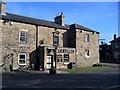
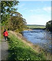
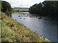
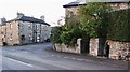
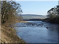
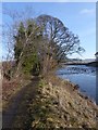


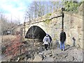
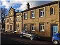
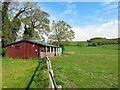
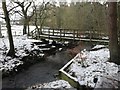
53 photos from this area
Area Information
Key information about the NE47 5AG including its size, population, and administrative classification.
- Area Type
- Postcode
- Area Size
- 5585 m²
- Population
- 1149
- Population Density
- 33 people/km²
House Prices in NE47 5AG
11
Properties
£310,167
Average Sold Price
£70,000
Lowest Price
£502,000
Highest Price
Showing 11 properties
| Address | Type | Beds | Baths | Last Sale Price | Last Sale Date | |
|---|---|---|---|---|---|---|
| White Gates, Stanegate Road Through Newbrough, Newbrough, NE47 5AG | Terraced | 4 | 2 | £502,000 | Sep 2025 | |
| Low Park, Stanegate Road Through Newbrough, Newbrough, NE47 5AG | Semi-detached | 4 | 2 | £365,000 | Jan 2025 | |
| Stanegate House, Stanegate Road Through Newbrough, Newbrough, NE47 5AG | house | - | - | £395,000 | Dec 2023 | |
| Overdale, Stanegate Road Through Newbrough, Newbrough, NE47 5AG | house | 3 | 2 | £405,000 | Apr 2023 | |
| Middle Cottage, Stanegate Road Through Newbrough, Newbrough, NE47 5AG | Terraced | 3 | - | £124,000 | Aug 2016 | |
| West Cottage, Stanegate Road Through Newbrough, Newbrough, NE47 5AG | Terraced | - | - | £70,000 | Nov 1999 | |
| Allergarth, Stanegate Road Through Newbrough, Newbrough, NE47 5AG | Detached | - | - | - | - | |
| Rose Cottage, Stanegate Road Through Newbrough, Newbrough, NE47 5AG | Terraced | - | - | - | - | |
| Old School House, Stanegate Road Through Newbrough, Newbrough, NE47 5AG | Terraced | - | - | - | - | |
| Forge House, Stanegate Road Through Newbrough, Newbrough, NE47 5AG | house | - | - | - | - |
Page 1 of 2
Energy Efficiency in NE47 5AG
Amenities
Schools
| Rank | School | Type | Entry gender | Ages |
|---|
Explore more schools in this area
Go to Schools tabDemographics
Household Size
Two person
most common
Accommodation Type
Houses
most common
Tenure
65
majority
Ethnic Group
White
most common
Religion
N/A
most common
Household Composition
N/A
most common
Age
47
median
Adults (30-64 years)
most common
Household Deprivation
N/A
with no deprivation
NS-SEC
38
in Lower managerial occupations
Explore more demographic insights in this area
Go to Demographics tabPlanning
Planning Constraints
- Flood RiskPremium
- Ramsar Wetland SitesPremium
- Area of Outstanding Natural BeautyPremium
- Protected Nature ReservePremium
- Protected WoodlandPremium