Area Overview for NE46 3PJ
Photos of NE46 3PJ

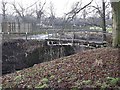
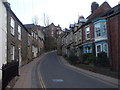
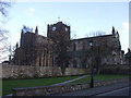


100 photos from this area
Area Information
Key information about the NE46 3PJ including its size, population, and administrative classification.
- Area Type
- Postcode
- Area Size
- 3.5 hectares
- Population
- 2266
- Population Density
- 183 people/km²
House Prices in NE46 3PJ
5
Properties
£193,000
Average Sold Price
£193,000
Lowest Price
£193,000
Highest Price
Showing 5 properties
| Address | Type | Beds | Baths | Last Sale Price | Last Sale Date | |
|---|---|---|---|---|---|---|
| 4 Alemouth Road, Hexham, NE46 3PJ | Flat | - | - | £193,000 | Jan 2022 | |
| 4A Alemouth Road, Hexham, NE46 3PJ | Maisonette | 4 | 3 | - | - | |
| Costa Coffee, Next, Alemouth Road, Hexham, NE46 3PJ | Restaurant | - | - | - | - | |
| Hexham's Hand Car Wash And Valeting, Hand Car Wash, Tesco Store, Alemouth Road, Hexham, NE46 3PJ | commercial | - | - | - | - | |
| Hexham Tyre & Battery Co Ltd, Hexham Tyre And Battery Co Ltd, Alemouth Road, Hexham, NE46 3PJ | office_workshop | - | - | - | - |
Energy Efficiency in NE46 3PJ
Amenities
Schools
| Rank | School | Type | Entry gender | Ages |
|---|
Explore more schools in this area
Go to Schools tabDemographics
Household Size
One person
most common
Accommodation Type
Houses
most common
Tenure
59
majority
Ethnic Group
White
most common
Religion
N/A
most common
Household Composition
N/A
most common
Age
47
median
Adults (30-64 years)
most common
Household Deprivation
N/A
with no deprivation
NS-SEC
33
in Lower managerial occupations
Explore more demographic insights in this area
Go to Demographics tabPlanning
Planning Constraints
- Flood RiskPremium
- Ramsar Wetland SitesPremium
- Area of Outstanding Natural BeautyPremium
- Protected Nature ReservePremium
- Protected WoodlandPremium