Area Overview for NE46 2JY
Photos of NE46 2JY
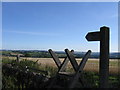
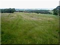
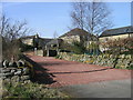
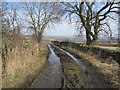
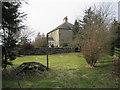
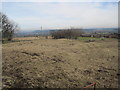
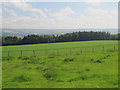
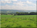
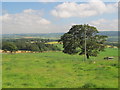
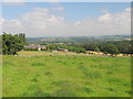
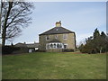
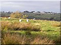
12 photos from this area
Area Information
Key information about the NE46 2JY including its size, population, and administrative classification.
- Area Type
- Postcode
- Area Size
- 1.8 km²
- Population
- 1368
- Population Density
- 11 people/km²
House Prices in NE46 2JY
15
Properties
£840,000
Average Sold Price
£840,000
Lowest Price
£840,000
Highest Price
Showing 15 properties
| Address | Type | Beds | Baths | Last Sale Price | Last Sale Date | |
|---|---|---|---|---|---|---|
| Dotland Grange, C 282 Whitley Chapel To Dipton Mill, Hexham, NE46 2JY | Detached | 4 | 4 | £840,000 | Jun 2019 | |
| Whitebeam, Dotland Farm, C 282 Whitley Chapel To Dipton Mill, Hexham, NE46 2JY | Semi-detached | 4 | 3 | - | - | |
| The Old Byre, Dotland Farm, C 282 Whitley Chapel To Dipton Mill, Hexham, NE46 2JY | Semi-detached | 4 | 2 | - | - | |
| Dotland Farm, C 282 Whitley Chapel To Dipton Mill, Hexham, NE46 2JY | Detached | 5 | 5 | - | - | |
| High Barns, Dotland Farm, C 282 Whitley Chapel To Dipton Mill, Hexham, NE46 2JY | Semi-detached | 5 | - | - | - | |
| The Granary, Dotland Farm, C 282 Whitley Chapel To Dipton Mill, Hexham, NE46 2JY | Semi-detached | 4 | - | - | - | |
| Tighvonie, Dotland Farm, C 282 Whitley Chapel To Dipton Mill, Hexham, NE46 2JY | Terraced | - | - | - | - | |
| The Cottage, Dotland Farm, C 282 Whitley Chapel To Dipton Mill, Hexham, NE46 2JY | house | - | - | - | - | |
| Harbut Law, Dotland Farm, C 282 Whitley Chapel To Dipton Mill, Hexham, NE46 2JY | Terraced | - | - | - | - | |
| Stable Cottage Dotland Town Foot, U 8075 Dotland Junction To Dotland Park Junction, Hexham, NE46 2JY | Bungalow | - | - | - | - |
Page 1 of 2
Energy Efficiency in NE46 2JY
Amenities
Schools
| Rank | School | Type | Entry gender | Ages |
|---|
Explore more schools in this area
Go to Schools tabDemographics
Household Size
Two person
most common
Accommodation Type
Houses
most common
Tenure
75
majority
Ethnic Group
White
most common
Religion
N/A
most common
Household Composition
N/A
most common
Age
47
median
Adults (30-64 years)
most common
Household Deprivation
N/A
with no deprivation
NS-SEC
42
in Lower managerial occupations
Explore more demographic insights in this area
Go to Demographics tabPlanning
Planning Constraints
- Flood RiskPremium
- Ramsar Wetland SitesPremium
- Area of Outstanding Natural BeautyPremium
- Protected Nature ReservePremium
- Protected WoodlandPremium