Area Overview for NE43 7PB
Photos of NE43 7PB
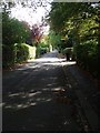
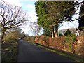
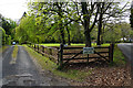
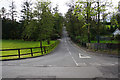
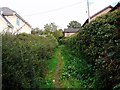
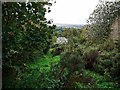
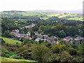
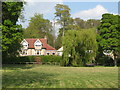
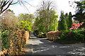
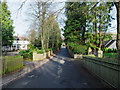
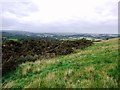
12 photos from this area
Area Information
Key information about the NE43 7PB including its size, population, and administrative classification.
- Area Type
- Postcode
- Area Size
- 4.4 hectares
- Population
- 1388
- Population Density
- 93 people/km²
House Prices in NE43 7PB
13
Properties
£572,813
Average Sold Price
£250,000
Lowest Price
£1,050,000
Highest Price
Showing 13 properties
| Address | Type | Beds | Baths | Last Sale Price | Last Sale Date | |
|---|---|---|---|---|---|---|
| The Limes, 9 Cade Hill Road, Stocksfield, NE43 7PB | house | - | - | £650,000 | Nov 2022 | |
| Birch House, 15 Cade Hill Road, Stocksfield, NE43 7PB | house | - | - | £685,000 | Dec 2021 | |
| Langley House, 4 Cade Hill Road, Stocksfield, NE43 7PB | Detached | 5 | 3 | £575,000 | Apr 2021 | |
| Bridge House, 13 Cade Hill Road, Stocksfield, NE43 7PB | Detached | 6 | 5 | £1,050,000 | Nov 2020 | |
| Fenholme, 10 Cade Hill Road, Stocksfield, NE43 7PB | Detached | 4 | 2 | £590,000 | May 2019 | |
| Ryedale, 3 Cade Hill Road, Stocksfield, NE43 7PB | Bungalow | 3 | - | £400,000 | Jan 2017 | |
| Birchwood, 19 Cade Hill Road, Stocksfield, NE43 7PB | Bungalow | - | - | £382,500 | Jun 2006 | |
| The Dene, 11 Cade Hill Road, Stocksfield, NE43 7PB | Detached | 6 | 4 | £250,000 | Dec 1996 | |
| Dearham Cottage, 8 Cade Hill Road, Stocksfield, NE43 7PB | Detached | - | - | - | - | |
| Glenhaven, 2 Cade Hill Road, Stocksfield, NE43 7PB | Detached | - | - | - | - |
Page 1 of 2
Energy Efficiency in NE43 7PB
Amenities
Schools
| Rank | School | Type | Entry gender | Ages |
|---|
Explore more schools in this area
Go to Schools tabDemographics
Household Size
Two person
most common
Accommodation Type
Houses
most common
Tenure
90
majority
Ethnic Group
White
most common
Religion
N/A
most common
Household Composition
N/A
most common
Age
47
median
Adults (30-64 years)
most common
Household Deprivation
N/A
with no deprivation
NS-SEC
53
in Lower managerial occupations
Explore more demographic insights in this area
Go to Demographics tabPlanning
Planning Constraints
- Flood RiskPremium
- Ramsar Wetland SitesPremium
- Area of Outstanding Natural BeautyPremium
- Protected Nature ReservePremium
- Protected WoodlandPremium