Area Overview for NE42 6RL
Photos of NE42 6RL
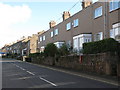
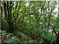
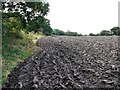
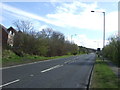

16 photos from this area
Area Information
Key information about the NE42 6RL including its size, population, and administrative classification.
- Area Type
- Postcode
- Area Size
- 1.3 hectares
- Population
- 2081
- Population Density
- 3169 people/km²
House Prices in NE42 6RL
17
Properties
£178,431
Average Sold Price
£85,000
Lowest Price
£245,000
Highest Price
Showing 17 properties
| Address | Type | Beds | Baths | Last Sale Price | Last Sale Date | |
|---|---|---|---|---|---|---|
| 18 Ruskin Court, Bewick Grange, Prudhoe, NE42 6RL | Detached | 4 | 2 | £245,000 | Mar 2017 | |
| 9 Ruskin Court, Bewick Grange, Prudhoe, NE42 6RL | Detached | 4 | 2 | £239,950 | Mar 2016 | |
| 10 Ruskin Court, Bewick Grange, Prudhoe, NE42 6RL | house | - | - | £167,500 | Nov 2012 | |
| 6 Ruskin Court, Bewick Grange, Prudhoe, NE42 6RL | Detached | - | - | £215,000 | Feb 2006 | |
| 4 Ruskin Court, Bewick Grange, Prudhoe, NE42 6RL | Detached | 3 | 2 | £172,500 | Aug 2004 | |
| 1 Ruskin Court, Bewick Grange, Prudhoe, NE42 6RL | Bungalow | - | - | £210,000 | Mar 2004 | |
| 8 Ruskin Court, Bewick Grange, Prudhoe, NE42 6RL | Detached | 3 | 1 | £85,000 | Aug 2001 | |
| 3 Ruskin Court, Bewick Grange, Prudhoe, NE42 6RL | Detached | - | - | £92,500 | Apr 2000 | |
| 16 Ruskin Court, Bewick Grange, Prudhoe, NE42 6RL | Bungalow | 3 | 2 | - | - | |
| 15 Ruskin Court, Bewick Grange, Prudhoe, NE42 6RL | house | 3 | - | - | - |
Page 1 of 2
Energy Efficiency in NE42 6RL
Amenities
Schools
| Rank | School | Type | Entry gender | Ages |
|---|
Explore more schools in this area
Go to Schools tabDemographics
Household Size
Two person
most common
Accommodation Type
Houses
most common
Tenure
79
majority
Ethnic Group
White
most common
Religion
N/A
most common
Household Composition
N/A
most common
Age
47
median
Adults (30-64 years)
most common
Household Deprivation
N/A
with no deprivation
NS-SEC
35
in Lower managerial occupations
Explore more demographic insights in this area
Go to Demographics tabPlanning
Planning Constraints
- Flood RiskPremium
- Ramsar Wetland SitesPremium
- Area of Outstanding Natural BeautyPremium
- Protected Nature ReservePremium
- Protected WoodlandPremium