Area Overview for NE42 6HE
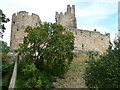
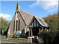
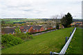
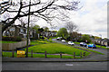
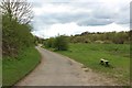
Photos of NE42 6HE


Area Information
NE42 6HE is a small, tightly knit residential area in England, covering just 15 hectares and home to 2,469 residents. Its compact size means it feels like a close-knit community, where daily life is shaped by the surrounding landscape and local amenities. The area’s population density of 913 people per square kilometre suggests a mix of established homes and a steady presence of families. While it lacks the sprawling infrastructure of larger towns, its proximity to rail networks and retail hubs offers a balance between rural tranquillity and practical connectivity. The area’s character is defined by its housing stock, with a strong emphasis on owner-occupied properties. This suggests a community of long-term residents, many of whom are in their prime working years, reflected in the median age of 47. Living here means navigating a small, manageable postcode with a focus on local services, though the flood risk assessment highlights a critical need for awareness of environmental challenges. For buyers, this area offers a snapshot of traditional English living, where convenience and community coexist with the realities of geographical constraints.
- Area Type
- Postcode
- Area Size
- 15.0 hectares
- Population
- 2469
- Population Density
- 913 people/km²
The property market in NE42 6HE is characterised by a high rate of home ownership, with 73% of properties occupied by their owners. This suggests a stable, long-term resident base, likely centred around family homes. The accommodation type is predominantly houses, which implies a focus on detached or semi-detached properties rather than flats or apartments. Given the area’s small size and the dominance of owner-occupied homes, the market is unlikely to be driven by rental demand. Buyers in this area may find a limited selection of properties, as the postcode covers only a small residential cluster. The concentration of houses may appeal to those seeking traditional, spacious homes, but it also means the market is less dynamic compared to areas with a higher proportion of rental properties. Prospective buyers should consider the area’s compact nature and the potential for limited new developments, as the existing stock is likely to be well-established.
House Prices in NE42 6HE
Showing 2 properties
| Address | Type | Beds | Baths | Last Sale Price | Last Sale Date | |
|---|---|---|---|---|---|---|
| S C A Hygiene Uk Ltd, Dhl Excel Supply Chain, Princess Way, Prudhoe, NE42 6HE | storage_distribution | - | - | - | - | |
| Fibre Board Building, Essity, Princess Way, Prudhoe, NE42 6HE | Industrial | - | - | - | - |
Energy Efficiency in NE42 6HE
The lifestyle in NE42 6HE is shaped by its proximity to rail stations and retail hubs, offering a blend of local convenience and regional connectivity. The five nearby rail stations, including Prudhoe and Wylam, provide regular services that link the area to surrounding towns, facilitating both commuting and leisure travel. For shopping, residents have access to well-known stores like Heron Prudhoe, Co-op Prudhoe, and Asda Prudhoe, ensuring everyday needs are met without long journeys. While the area’s small size means fewer large-scale amenities, the presence of these essential services supports a self-sufficient lifestyle. The lack of detailed data on parks or leisure facilities means the area’s recreational options remain unclear, but the rail and retail infrastructure suggests a focus on practicality over expansive leisure opportunities.
Amenities
Schools
The nearest schools to NE42 6HE include Prudhoe Castle First School, which operates as both a primary school and an academy. While the data does not specify Ofsted ratings, the presence of both primary and academy status suggests a range of educational options for families. The school’s dual designation may indicate a blend of traditional and potentially more autonomous educational approaches, though the exact implications for quality or curriculum are not detailed. For parents, the availability of a single school within practical reach could be both a convenience and a limitation, depending on the family’s needs. The absence of additional schools in the data means the area’s educational landscape is not extensively covered, but the existing institution appears to serve the local community. Families considering NE42 6HE should investigate the school’s performance and facilities independently, as the data provides only basic categorisation.
| Rank | School | Type | Entry gender | Ages |
|---|
Explore more schools in this area
Go to Schools tabDemographics
The population of NE42 6HE skews towards adults aged 30–64, making up the most common age range, with a median age of 47. This suggests a stable community with a strong presence of working-age individuals and families. Home ownership is high at 73%, indicating a preference for long-term residency over rental properties. The accommodation type is predominantly houses, which aligns with the area’s lower density and likely suburban or semi-rural layout. The predominant ethnic group is White, though no specific data on diversity or deprivation is provided. The absence of detailed diversity metrics means the community’s composition remains largely unexplored in the data. The age profile and ownership figures suggest a mature, settled population, possibly with fewer young families or transient residents. This demographic profile may influence local services and amenities, tailored to the needs of middle-aged households rather than younger or older demographics.
Household Size
Accommodation Type
Tenure
Ethnic Group
Religion
Household Composition
Age
Household Deprivation
NS-SEC
Explore more demographic insights in this area
Go to Demographics tabPlanning
Planning Constraints
- Flood RiskPremium
- Ramsar Wetland SitesPremium
- Area of Outstanding Natural BeautyPremium
- Protected Nature ReservePremium
- Protected WoodlandPremium