Area Overview for NE42 6EF
Photos of NE42 6EF
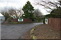
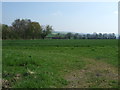
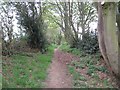
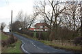
6 photos from this area
Area Information
Key information about the NE42 6EF including its size, population, and administrative classification.
- Area Type
- Postcode
- Area Size
- 61.5 hectares
- Population
- 1317
- Population Density
- 32 people/km²
House Prices in NE42 6EF
10
Properties
£204,083
Average Sold Price
£50,000
Lowest Price
£400,000
Highest Price
Showing 10 properties
| Address | Type | Beds | Baths | Last Sale Price | Last Sale Date | |
|---|---|---|---|---|---|---|
| Overdene Cottage, Overdene Access Road, Ovington, NE42 6EF | Bungalow | 2 | 1 | £230,000 | Nov 2020 | |
| Holly Hurst, Overdene Access Road, Ovington, NE42 6EF | Bungalow | 3 | 1 | £187,000 | Apr 2020 | |
| Overdene Grange, Overdene Access Road, Ovington, NE42 6EF | Detached | - | - | £50,000 | Feb 2020 | |
| Linden, 5 Overdene Access Road, Ovington, NE42 6EF | Detached | 3 | 3 | £287,500 | Mar 2017 | |
| Overdene, Overdene Access Road, Ovington, NE42 6EF | Land | 3 | - | £400,000 | Jul 2003 | |
| Tinmuth, Overdene Access Road, Ovington, NE42 6EF | Detached | 4 | 2 | £70,000 | Sep 1996 | |
| Jersey Close, 3 Overdene Access Road, Ovington, NE42 6EF | Detached | - | - | - | - | |
| 21, Eastside, Partnership Field, Springwell, Ovington, NE42 6EF | hotel | - | - | - | - | |
| St Aidans, Overdene Access Road, Ovington, NE42 6EF | Detached | - | - | - | - | |
| Mayfield, Overdene Access Road, Ovington, NE42 6EF | Bungalow | - | - | - | - |
Energy Efficiency in NE42 6EF
Amenities
Schools
| Rank | School | Type | Entry gender | Ages |
|---|
Explore more schools in this area
Go to Schools tabDemographics
Household Size
Two person
most common
Accommodation Type
Houses
most common
Tenure
66
majority
Ethnic Group
White
most common
Religion
N/A
most common
Household Composition
N/A
most common
Age
47
median
Adults (30-64 years)
most common
Household Deprivation
N/A
with no deprivation
NS-SEC
45
in Lower managerial occupations
Explore more demographic insights in this area
Go to Demographics tabPlanning
Planning Constraints
- Flood RiskPremium
- Ramsar Wetland SitesPremium
- Area of Outstanding Natural BeautyPremium
- Protected Nature ReservePremium
- Protected WoodlandPremium