Area Overview for NE41 8AW
Photos of NE41 8AW
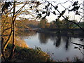
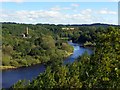
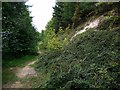
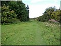
83 photos from this area
Area Information
Key information about the NE41 8AW including its size, population, and administrative classification.
- Area Type
- Postcode
- Area Size
- 9.6 hectares
- Population
- 1978
- Population Density
- 505 people/km²
House Prices in NE41 8AW
12
Properties
£358,250
Average Sold Price
£250,000
Lowest Price
£480,000
Highest Price
Showing 12 properties
| Address | Type | Beds | Baths | Last Sale Price | Last Sale Date | |
|---|---|---|---|---|---|---|
| Willow Cottage, Ovingham Road, Wylam, NE41 8AW | Semi-detached | 2 | 1 | £267,500 | Jun 2021 | |
| West Mews, Ovingham Road, Wylam, NE41 8AW | house | - | - | £480,000 | Jul 2020 | |
| Iveagh Cottage, Ovingham Road, Wylam, NE41 8AW | house | - | - | £350,000 | Oct 2016 | |
| Brewery House, Ovingham Road, Wylam, NE41 8AW | Terraced | - | - | £412,000 | Jun 2016 | |
| Harby House, Ovingham Road, Wylam, NE41 8AW | house | 4 | - | £390,000 | May 2012 | |
| Willow House, Ovingham Road, Wylam, NE41 8AW | Terraced | - | - | £250,000 | Nov 2001 | |
| Wylam Lodge, Ovingham Road, Wylam, NE41 8AW | Retail | 2 | - | - | - | |
| Cintra House, Ovingham Road, Wylam, NE41 8AW | Unknown | - | - | - | - | |
| The Garden Lodge, Ovingham Road, Wylam, NE41 8AW | house | - | - | - | - | |
| West House, Ovingham Road, Wylam, NE41 8AW | Terraced | - | - | - | - |
Page 1 of 2
Energy Efficiency in NE41 8AW
Amenities
Schools
| Rank | School | Type | Entry gender | Ages |
|---|
Explore more schools in this area
Go to Schools tabDemographics
Household Size
Two person
most common
Accommodation Type
Houses
most common
Tenure
82
majority
Ethnic Group
White
most common
Religion
N/A
most common
Household Composition
N/A
most common
Age
47
median
Adults (30-64 years)
most common
Household Deprivation
N/A
with no deprivation
NS-SEC
55
in Lower managerial occupations
Explore more demographic insights in this area
Go to Demographics tabPlanning
Planning Constraints
- Flood RiskPremium
- Ramsar Wetland SitesPremium
- Area of Outstanding Natural BeautyPremium
- Protected Nature ReservePremium