Area Overview for NE40 4FH
Photos of NE40 4FH

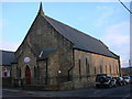
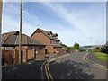
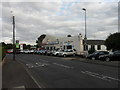
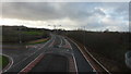
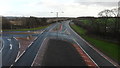
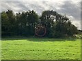
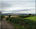
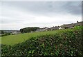
14 photos from this area
Area Information
Key information about the NE40 4FH including its size, population, and administrative classification.
- Area Type
- Postcode
- Area Size
- 1.6 hectares
- Population
- 2678
- Population Density
- 511 people/km²
House Prices in NE40 4FH
19
Properties
£561,882
Average Sold Price
£207,995
Lowest Price
£4,750,000
Highest Price
Showing 19 properties
| Address | Type | Beds | Baths | Last Sale Price | Last Sale Date | |
|---|---|---|---|---|---|---|
| 16 Brockwell Place, Crawcrook, Ryton, NE40 4FH | house | - | - | £365,000 | Sep 2025 | |
| 10 Brockwell Place, Crawcrook, Ryton, NE40 4FH | house | - | - | £349,950 | May 2024 | |
| 6 Brockwell Place, Crawcrook, Ryton, NE40 4FH | Detached | 4 | 2 | £312,995 | Mar 2022 | |
| 7 Brockwell Place, Crawcrook, Ryton, NE40 4FH | house | - | - | £319,995 | Mar 2022 | |
| 5 Brockwell Place, Crawcrook, Ryton, NE40 4FH | house | - | - | £319,995 | Feb 2022 | |
| 15 Brockwell Place, Crawcrook, Ryton, NE40 4FH | house | - | - | £279,995 | Feb 2022 | |
| 14 Brockwell Place, Crawcrook, Ryton, NE40 4FH | house | - | - | £314,995 | Jan 2022 | |
| 8 Brockwell Place, Crawcrook, Ryton, NE40 4FH | house | - | - | £324,995 | Jan 2022 | |
| 9 Brockwell Place, Crawcrook, Ryton, NE40 4FH | house | - | - | £347,495 | Jan 2022 | |
| 11 Brockwell Place, Crawcrook, Ryton, NE40 4FH | house | - | - | £397,495 | Dec 2021 |
Page 1 of 2
Energy Efficiency in NE40 4FH
Amenities
Schools
| Rank | School | Type | Entry gender | Ages |
|---|
Explore more schools in this area
Go to Schools tabDemographics
Household Size
Family (3-5 people)
most common
Accommodation Type
Houses
most common
Tenure
86
majority
Ethnic Group
White
most common
Religion
N/A
most common
Household Composition
N/A
most common
Age
47
median
Adults (30-64 years)
most common
Household Deprivation
N/A
with no deprivation
NS-SEC
46
in Lower managerial occupations
Explore more demographic insights in this area
Go to Demographics tabPlanning
Planning Constraints
- Flood RiskPremium
- Ramsar Wetland SitesPremium
- Area of Outstanding Natural BeautyPremium
- Protected Nature ReservePremium
- Protected WoodlandPremium