Area Overview for NE40 3RW
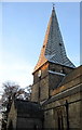
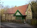
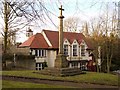
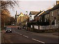
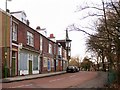
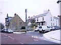
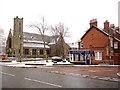
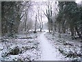
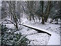
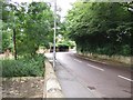
Photos of NE40 3RW

Area Information
Living in NE40 3RW offers a compact, tightly knit residential experience within a small cluster of 1.4 hectares. With a population of 1,425, the area is densely populated, yet its size fosters a close-knit community feel. The median age of 47 suggests a stable, mature demographic, with adults aged 30–64 forming the majority. This is a predominantly owner-occupied area, with 67% of homes owned by residents, and houses making up the primary accommodation type. Daily life here is shaped by proximity to essential services and transport links, with nearby shops, rail stations, and the Newcastle Airport within practical reach. The area’s low flood risk and below-average crime rates add to its appeal, offering a balance of safety and convenience. While small, NE40 3RW is well-connected to surrounding regions, making it a viable choice for those seeking a residential hub with easy access to broader networks.
- Area Type
- Postcode
- Area Size
- 1.4 hectares
- Population
- 1425
- Population Density
- 105416 people/km²
The property market in NE40 3RW is dominated by owner-occupied homes, with 67% of properties owned by residents rather than rented. The area’s primary accommodation type is houses, which contrasts with regions where flats or apartments predominate. This suggests a housing stock tailored to families or individuals seeking more space, though the small area size means the number of available properties is limited. Buyers should consider the compact nature of the area, as the immediate surroundings may offer few alternatives. The high home ownership rate indicates a stable market with potential for long-term value retention. However, the limited scale of the area may mean fewer options for those seeking specific property types or larger homes.
House Prices in NE40 3RW
Showing 36 properties
| Address | Type | Beds | Baths | Last Sale Price | Last Sale Date | |
|---|---|---|---|---|---|---|
| 12 Parkfield, Ryton Central, Ryton, NE40 3RW | Semi-detached | 3 | 1 | £175,000 | Feb 2025 | |
| 30 Parkfield, Ryton Central, Ryton, NE40 3RW | Semi-detached | 3 | 1 | £165,000 | Nov 2024 | |
| 98 Parkfield, Ryton Central, Ryton, NE40 3RW | Semi-detached | 3 | 1 | £146,000 | Aug 2024 | |
| 23 Parkfield, Ryton Central, Ryton, NE40 3RW | Semi-detached | 2 | 1 | £155,000 | Jul 2024 | |
| 20 Parkfield, Ryton Central, Ryton, NE40 3RW | Semi-detached | 2 | 1 | £150,000 | Jun 2024 | |
| 89 Parkfield, Ryton Central, Ryton, NE40 3RW | house | - | - | £150,000 | Jun 2024 | |
| 91 Parkfield, Ryton Central, Ryton, NE40 3RW | house | - | - | £175,000 | Nov 2023 | |
| 16 Parkfield, Ryton Central, Ryton, NE40 3RW | Semi-detached | 2 | 1 | £110,000 | Feb 2021 | |
| 21 Parkfield, Ryton Central, Ryton, NE40 3RW | Semi-detached | 2 | 1 | £97,750 | Oct 2020 | |
| 29 Parkfield, Ryton Central, Ryton, NE40 3RW | Semi-detached | 3 | 1 | £140,000 | Dec 2019 |
Energy Efficiency in NE40 3RW
Residents of NE40 3RW have access to a range of amenities within practical reach, including five retail outlets such as Co-op Ryton, Co-op Crawcrook, and Morrisons Daily. These shops provide everyday convenience for groceries and essentials. The area’s transport links to rail and metro stations, including Wylam and Blaydon stations, connect residents to broader networks for commuting or travel. The proximity to Newcastle Airport adds to the area’s accessibility. While specific parks or leisure facilities are not detailed in the data, the presence of multiple transport options and retail venues suggests a lifestyle that prioritises convenience and connectivity. The compact nature of the area means amenities are closely clustered, reducing the need for long commutes to access services.
Amenities
Schools
| Rank | School | Type | Entry gender | Ages |
|---|
Explore more schools in this area
Go to Schools tabDemographics
NE40 3RW’s population of 1,425 is predominantly composed of adults aged 30–64, reflecting a mature, established community. The median age of 47 underscores this stability, with fewer younger or older residents compared to other areas. Home ownership is high at 67%, indicating a strong presence of long-term residents. The area is largely composed of houses, which aligns with the demographic profile of families and individuals seeking more space. The predominant ethnic group is White, though no specific diversity statistics are provided. The population density of 105,416 people per square kilometre highlights the compact nature of the area, which may influence the character of local interactions and community dynamics. These figures collectively suggest a settled, low-turnover environment where residents are likely to have established roots.
Household Size
Accommodation Type
Tenure
Ethnic Group
Religion
Household Composition
Age
Household Deprivation
NS-SEC
Explore more demographic insights in this area
Go to Demographics tabPlanning
Planning Constraints
- Flood RiskPremium
- Ramsar Wetland SitesPremium
- Area of Outstanding Natural BeautyPremium
- Protected Nature ReservePremium
- Protected WoodlandPremium