Area Overview for NE40 3PN
Photos of NE40 3PN
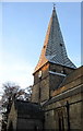

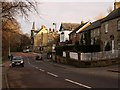
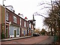
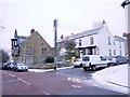
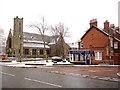
81 photos from this area
Area Information
Key information about the NE40 3PN including its size, population, and administrative classification.
- Area Type
- Postcode
- Area Size
- 1.6 hectares
- Population
- 1503
- Population Density
- 1112 people/km²
House Prices in NE40 3PN
8
Properties
£335,900
Average Sold Price
£235,000
Lowest Price
£410,550
Highest Price
Showing 8 properties
| Address | Type | Beds | Baths | Last Sale Price | Last Sale Date | |
|---|---|---|---|---|---|---|
| The Oaks, 4 Holburn Lane Court, Ryton Central, Ryton, NE40 3PN | house | 4 | 2 | £410,000 | Mar 2022 | |
| The Pines, 8 Holburn Lane Court, Ryton Central, Ryton, NE40 3PN | Detached | 4 | 1 | £410,550 | Aug 2021 | |
| The Willows, 9 Holburn Lane Court, Ryton Central, Ryton, NE40 3PN | Detached | 4 | 2 | £336,000 | Oct 2018 | |
| The Elms, 5 Holburn Lane Court, Ryton Central, Ryton, NE40 3PN | Semi-detached | 4 | 2 | £235,000 | Jan 2017 | |
| The Beeches, 7 Holburn Lane Court, Ryton Central, Ryton, NE40 3PN | Detached | - | - | £287,950 | Aug 2004 | |
| 1, Fern Dene House, Holburn Lane Court, Ryton Central, Ryton, NE40 3PN | Detached | 4 | - | - | - | |
| 2, Fern Dene House, Holburn Lane Court, Ryton Central, Ryton, NE40 3PN | Detached | - | - | - | - | |
| The Sycamores, 6 Holburn Lane Court, Ryton Central, Ryton, NE40 3PN | Semi-detached | - | - | - | - |
Energy Efficiency in NE40 3PN
Amenities
Schools
| Rank | School | Type | Entry gender | Ages |
|---|
Explore more schools in this area
Go to Schools tabDemographics
Household Size
Two person
most common
Accommodation Type
Houses
most common
Tenure
83
majority
Ethnic Group
White
most common
Religion
N/A
most common
Household Composition
N/A
most common
Age
47
median
Elderly (65+ years)
most common
Household Deprivation
N/A
with no deprivation
NS-SEC
37
in Lower managerial occupations
Explore more demographic insights in this area
Go to Demographics tabPlanning
Planning Constraints
- Flood RiskPremium
- Ramsar Wetland SitesPremium
- Area of Outstanding Natural BeautyPremium
- Protected Nature ReservePremium
- Protected WoodlandPremium