Area Overview for NE40 3LN
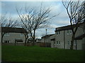
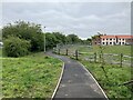
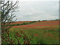
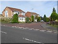
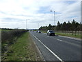
Photos of NE40 3LN

Area Information
Living in NE40 3LN means being part of a tightly knit residential cluster in England, where 1,538 people reside across 5,820 square metres. The area’s high population density—264,269 people per square kilometre—suggests a compact, community-focused environment. This postcode is not a sprawling suburb but a small, defined space with practical access to nearby amenities. Residents benefit from proximity to retail outlets like Co-op Ryton and Morrisons Daily, as well as rail stations such as Wylam and Blaydon. The area’s digital connectivity is strong, with a broadband score of 94, ensuring reliable internet for work or leisure. While the population skews older, with a median age of 47, the presence of adults aged 30–64 suggests a stable demographic. Living here means balancing proximity to transport networks with the quietude of a residential enclave. The lack of protected natural sites or planning constraints means development is unencumbered, though the moderate crime risk score of 58 underscores the need for standard security measures. For those seeking a mix of convenience and simplicity, NE40 3LN offers a focused, accessible lifestyle.
- Area Type
- Postcode
- Area Size
- 5820 m²
- Population
- 1538
- Population Density
- 2139 people/km²
The property market in NE40 3LN is characterised by a 51% home ownership rate, with houses being the predominant accommodation type. This suggests a mix of owner-occupied properties and rentals, though the small area size means the housing stock is limited. The focus on houses rather than flats or apartments may appeal to buyers seeking more space, though the compact nature of the postcode means properties are unlikely to be large. For buyers, this small cluster implies a competitive market with limited scope for expansion. Proximity to rail and metro stations—such as Wylam and Blaydon—adds value, as does the area’s digital connectivity. However, the lack of planning constraints or protected sites means development is not restricted, which could influence future property values. Buyers should consider the area’s size and the need for proximity to transport when evaluating properties.
House Prices in NE40 3LN
Showing 14 properties
| Address | Type | Beds | Baths | Last Sale Price | Last Sale Date | |
|---|---|---|---|---|---|---|
| 11 The Ridge, Ryton Central, Ryton, NE40 3LN | Semi-detached | 3 | 1 | £295,000 | May 2025 | |
| 5 The Ridge, Ryton Central, Ryton, NE40 3LN | Semi-detached | 3 | 1 | £240,000 | Dec 2024 | |
| 12 The Ridge, Ryton Central, Ryton, NE40 3LN | Semi-detached | 4 | 2 | £280,000 | Jun 2023 | |
| 3 The Ridge, Ryton Central, Ryton, NE40 3LN | Retail | 4 | 1 | £253,000 | Aug 2022 | |
| 7 The Ridge, Ryton Central, Ryton, NE40 3LN | Semi-detached | 3 | 2 | £203,000 | Jul 2020 | |
| 13 The Ridge, Ryton Central, Ryton, NE40 3LN | Semi-detached | 3 | 1 | £175,000 | Dec 2017 | |
| 10 The Ridge, Ryton Central, Ryton, NE40 3LN | Semi-detached | 3 | - | £197,000 | Sep 2017 | |
| 1 The Ridge, Ryton Central, Ryton, NE40 3LN | Semi-detached | 4 | - | £212,000 | Jun 2017 | |
| 2 The Ridge, Ryton Central, Ryton, NE40 3LN | house | - | - | £195,000 | Jan 2011 | |
| 4 The Ridge, Ryton Central, Ryton, NE40 3LN | Semi-detached | - | - | £169,950 | Sep 2006 |
Energy Efficiency in NE40 3LN
Residents of NE40 3LN have access to a range of amenities within practical reach. Local shops include Co-op Ryton, Co-op Crawcrook, and Morrisons Daily, providing essential retail and grocery needs. The area’s rail stations—Wylam, Blaydon, and Prudhoe—offer connections to broader transport networks, while metro stops like Bank Foot and Kingston Park add flexibility. Newcastle Airport is also nearby, making travel straightforward. The presence of multiple retail outlets and transport hubs suggests a lifestyle focused on convenience and accessibility. While the area lacks major leisure or cultural landmarks, its proximity to transport links allows easy exploration of surrounding regions. The compact nature of NE40 3LN means amenities are closely clustered, fostering a sense of community but requiring residents to prioritise proximity when choosing where to live.
Amenities
Schools
| Rank | School | Type | Entry gender | Ages |
|---|
Explore more schools in this area
Go to Schools tabDemographics
NE40 3LN’s population of 1,538 is predominantly White, with 51% of residents owning their homes. The area’s median age of 47 indicates a mature demographic, with the majority of residents falling within the 30–64 age range. This suggests a community of established professionals and families, rather than students or young renters. The high home ownership rate—51%—points to a stable housing market, though the area’s small size means property availability is limited. The accommodation type is primarily houses, which may appeal to those seeking more space than flats. The absence of specific deprivation data means quality of life is inferred from amenities and connectivity. With 51% of homes owned, the area is neither heavily rental-driven nor entirely owner-occupied, creating a balanced housing mix. The demographic profile implies a community focused on long-term residency, with limited turnover.
Household Size
Accommodation Type
Tenure
Ethnic Group
Religion
Household Composition
Age
Household Deprivation
NS-SEC
Explore more demographic insights in this area
Go to Demographics tabPlanning
Planning Constraints
- Flood RiskPremium
- Ramsar Wetland SitesPremium
- Area of Outstanding Natural BeautyPremium
- Protected Nature ReservePremium
- Protected WoodlandPremium