Area Overview for NE40 3BY
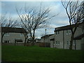
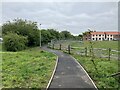
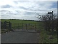
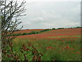
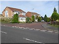
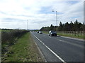
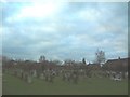
Photos of NE40 3BY
Area Information
Living in NE40 3BY offers a compact, residential experience shaped by its small area size of 1.8 hectares and a population of 2,678. This postcode cluster is characterised by a mature demographic, with a median age of 47 and a majority of residents aged 30–64. The area is predominantly owner-occupied, with 86% of homes in private hands, suggesting a stable, long-term community. Daily life here balances quiet domesticity with proximity to essential services. The density of 511 people per square kilometre indicates a tight-knit neighbourhood, where social interactions are likely frequent. Residents benefit from nearby schools, rail links, and retail hubs, ensuring convenience without the sprawl of larger towns. The low crime risk and absence of environmental constraints make it an attractive option for families seeking a safe, manageable living environment. While small, NE40 3BY’s strategic location near transport corridors and amenities ensures it is not isolated, offering a blend of local charm and practical connectivity.
- Area Type
- Postcode
- Area Size
- 1.8 hectares
- Population
- 2678
- Population Density
- 511 people/km²
The property market in NE40 3BY is defined by high home ownership (86%) and a predominance of houses. This suggests a market skewed toward owner-occupied properties rather than rental investments. The small area size of 1.8 hectares means the housing stock is limited, likely concentrated in a few clusters. For buyers, this creates a competitive environment where properties may be in demand due to their scarcity. The focus on houses rather than flats or apartments aligns with the area’s mature demographic, appealing to families or retirees seeking space. Proximity to schools, rail links, and retail amenities adds value, though the small size of the postcode means buyers must consider nearby areas for more options. The market is likely stable, with fewer fluctuations due to the low turnover of homes.
House Prices in NE40 3BY
Showing 73 properties
| Address | Type | Beds | Baths | Last Sale Price | Last Sale Date | |
|---|---|---|---|---|---|---|
| 48 Argus Gardens, Ryton Central, Ryton, NE40 3BY | Detached | 2 | 1 | - | - | |
| 2 Argus Gardens, Ryton Central, Ryton, NE40 3BY | Detached | 4 | 2 | - | - | |
| 35 Argus Gardens, Ryton Central, Ryton, NE40 3BY | house | - | - | - | - | |
| 66 Argus Gardens, Ryton Central, Ryton, NE40 3BY | house | - | - | - | - | |
| 4 Argus Gardens, Ryton Central, Ryton, NE40 3BY | house | - | - | - | - | |
| 38 Argus Gardens, Ryton Central, Ryton, NE40 3BY | house | - | - | - | - | |
| 65 Argus Gardens, Ryton Central, Ryton, NE40 3BY | house | - | - | - | - | |
| 26 Argus Gardens, Ryton Central, Ryton, NE40 3BY | house | - | - | - | - | |
| 28 Argus Gardens, Ryton Central, Ryton, NE40 3BY | house | - | - | - | - | |
| 55 Argus Gardens, Ryton Central, Ryton, NE40 3BY | house | - | - | - | - |
Energy Efficiency in NE40 3BY
The lifestyle in NE40 3BY is shaped by its proximity to essential amenities. Retail options include Co-op stores in Ryton, Crawcrook, and Winlaton, offering everyday shopping convenience. Rail and metro stations provide easy access to nearby towns and cities, while Newcastle Airport caters to travel needs. The area’s compact size means residents can access these services without long commutes. The presence of multiple schools, combined with transport links, supports a family-friendly environment. Parks and leisure facilities are not explicitly listed, but the low environmental risk and absence of planning constraints suggest open spaces may be available nearby. This balance of practicality and accessibility contributes to a comfortable, community-oriented lifestyle.
Amenities
Schools
Residents of NE40 3BY have access to two primary schools: St Mary and St Thomas Aquinas Catholic Primary School, and St Mary & St Thomas Aquinas Catholic Primary School in Blaydon, which holds an Ofsted rating of outstanding. Both institutions cater to younger families, with the Blaydon school’s top rating indicating high-quality education. The presence of two primary schools within practical reach ensures flexibility for parents, reducing travel time and competition for places. The Catholic affiliation may appeal to families seeking faith-based education. With a population of 2,678, the area’s schools are likely to be well-resourced, supporting the needs of local children. This makes NE40 3BY particularly attractive to families prioritising strong educational foundations.
| Rank | School | Type | Entry gender | Ages |
|---|
Explore more schools in this area
Go to Schools tabDemographics
NE40 3BY’s population of 2,678 is dominated by adults aged 30–64, reflecting a mature, established community. The median age of 47 suggests a mix of long-term residents and those in mid-career. Home ownership is high at 86%, with houses being the primary accommodation type. This indicates a preference for private, family-oriented living rather than rental properties. The predominant ethnic group is White, though no specific data on diversity or deprivation is provided. The age profile implies a community with strong generational continuity, where many residents may be raising children or nearing retirement. The absence of younger demographics or transient populations suggests a focus on stability. For buyers, this demographic structure may translate to a neighbourhood with well-maintained properties and a low turnover of homes.
Household Size
Accommodation Type
Tenure
Ethnic Group
Religion
Household Composition
Age
Household Deprivation
NS-SEC
Explore more demographic insights in this area
Go to Demographics tabPlanning
Planning Constraints
- Flood RiskPremium
- Ramsar Wetland SitesPremium
- Area of Outstanding Natural BeautyPremium
- Protected Nature ReservePremium
- Protected WoodlandPremium