Area Overview for NE4 9YA
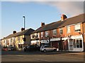
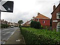
Photos of NE4 9YA


Area Information
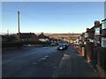
Living in NE4 9YA means inhabiting a compact, densely populated residential cluster in England’s northeast. The area covers just 1632 square metres, housing 1198 people, resulting in a population density of 734,132 people per square kilometre. This makes NE4 9YA one of the most densely populated postcode areas in the UK, with a tight-knit community feel. The area’s small size means residents are likely to know their neighbours, and local amenities are within easy reach. Despite its density, the area shows no signs of environmental constraints like protected woodlands or wetlands, which could complicate development. Its proximity to Newcastle Airport and multiple railway stations suggests it is well-connected to regional hubs. The demographic profile—predominantly adults aged 30–64, with a median age of 47—hints at a mature, stable population. For buyers, this is a small but functional area, ideal for those seeking proximity to transport links and essential services without the sprawl of larger towns.
- Area Type
- Postcode
- Area Size
- 1632 m²
- Population
- 1198
- Population Density
- 5096 people/km²
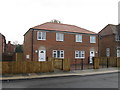
The property market in NE4 9YA is characterised by a 40% home ownership rate, which is below the national average, suggesting a rental market with significant private tenancy. The predominant accommodation type is houses, which is notable given the area’s high population density. This mix of larger properties in a compact space may indicate older housing stock or recent conversions of commercial spaces into residential units. For buyers, this small area offers limited scope for property diversity, with most options being single-family homes. The low home ownership rate could mean competition from renters, potentially affecting price stability. Proximity to transport links like railway stations and the nearby Newcastle Airport might attract commuters, though the area’s size means any property search would be highly localised. Buyers should consider the area’s density and the potential for limited future development when evaluating long-term value.
House Prices in NE4 9YA
Showing 3 properties
| Address | Type | Beds | Baths | Last Sale Price | Last Sale Date | |
|---|---|---|---|---|---|---|
| 48 Cedar Road, Newcastle Upon Tyne, NE4 9YA | Semi-detached | 3 | - | £138,500 | Nov 2015 | |
| 50 Cedar Road, Newcastle Upon Tyne, NE4 9YA | Semi-detached | - | - | - | - | |
| 46 Cedar Road, Newcastle Upon Tyne, NE4 9YA | house | - | - | - | - |
Energy Efficiency in NE4 9YA
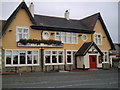
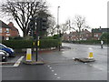
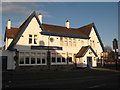
Daily life in NE4 9YA is shaped by its proximity to essential amenities. Retail options include Co-op Cedar, Spar, and Tesco Fenham W, providing convenience for groceries and everyday purchases. The area’s railway stations—Metrocentre, Blaydon, and Dunston—offer easy access to regional transport, while the nearby Newcastle Airport caters to travel needs. Public transport includes the Rhodes Street bus route, connecting residents to broader networks. Though the data does not mention parks or leisure facilities, the absence of planning constraints like AONBs or protected woodlands suggests space for informal recreation. The compact nature of the area means amenities are closely grouped, reducing travel time for errands. However, the lack of detailed information on dining or cultural venues means the full character of the local lifestyle remains partially undefined.
Amenities
Schools
Residents of NE4 9YA have access to two primary schools: West Gate Community College and Rutherford School. Both institutions cater to younger children, providing essential early education for families in the area. The presence of two primary schools within practical reach reduces the need for long commutes, though no secondary schools are listed in the data. The mix of schools suggests a focus on foundational education, which is typical for smaller residential clusters. Families with children may benefit from the proximity of these schools, though the absence of secondary education options could necessitate travel to nearby towns. The lack of data on Ofsted ratings means the quality of education cannot be assessed here, but the availability of two primary schools indicates a basic infrastructure to support local families.
| Rank | School | Type | Entry gender | Ages |
|---|
Explore more schools in this area
Go to Schools tabDemographics
NE4 9YA’s population skews toward middle-aged adults, with a median age of 47 and the majority of residents falling within the 30–64 age range. This suggests a community of established professionals and families, with fewer young children or retirees compared to other areas. Home ownership rates are relatively low at 40%, indicating a mix of renters and owner-occupiers. The predominant accommodation type is houses, which is unusual in such a densely packed area, hinting at a blend of older, larger properties and newer developments. The predominant ethnic group is White, with no specific data provided on other ethnicities. While the area’s high population density might suggest limited space for expansion, the lack of planning constraints like AONBs or protected woodlands means development pressure is minimal. The demographic profile implies a stable, low-mobility population, which can be advantageous for those seeking a consistent community environment.
Household Size
Accommodation Type
Tenure
Ethnic Group
Religion
Household Composition
Age
Household Deprivation
NS-SEC
Explore more demographic insights in this area
Go to Demographics tabPlanning
Planning Constraints
- Flood RiskPremium
- Ramsar Wetland SitesPremium
- Area of Outstanding Natural BeautyPremium
- Protected Nature ReservePremium
- Protected WoodlandPremium