Area Overview for NE4 9XZ
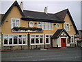
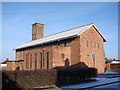
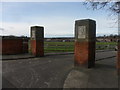
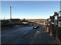
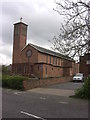
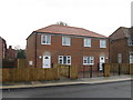
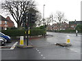
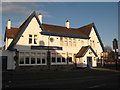
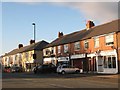
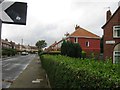
Photos of NE4 9XZ


Area Information
NE4 9XZ is a small, tightly packed residential cluster in England, spanning just 1.3 hectares and home to 1,044 residents. Its high population density of 80,495 people per square kilometre reflects a compact, closely knit community. The area is characterised by its focus on family living, with a median age of 47 and a majority of residents aged between 30 and 64. This suggests a balance of established families and mature professionals. The presence of multiple Sacred Heart schools nearby underscores the area’s appeal to households with children. While the postcode is small, its proximity to retail hubs like Spar, Co-op Cedar, and Morrisons Fenham, along with accessible rail and metro links, ensures daily life is convenient. The area’s limited size means it is unlikely to expand significantly, making it a stable but tightly defined neighbourhood. For buyers, NE4 9XZ offers a mix of practicality and proximity to essential services, though its small footprint means housing options are limited to existing properties.
- Area Type
- Postcode
- Area Size
- 1.3 hectares
- Population
- 1044
- Population Density
- 4291 people/km²
NE4 9XZ is primarily composed of houses, with 48% of properties owner-occupied. This suggests a mix of long-term residents and renters, though the small area size and high population density indicate limited housing stock. The concentration of houses may appeal to families seeking more space, but the area’s compact nature means expansion is unlikely. Buyers should consider the limited availability of new properties and the potential for competition in the existing market. The high population density also means properties are closely spaced, which could affect privacy and outdoor space. For those prioritising proximity to schools and transport, NE4 9XZ offers convenience, but its small footprint means buyers must evaluate properties carefully to ensure they meet their needs.
House Prices in NE4 9XZ
No properties found in this postcode.
Energy Efficiency in NE4 9XZ
Daily life in NE4 9XZ is supported by a range of amenities within walking or short transit distance. Retail options include Spar, Co-op Cedar, and Morrisons Fenham, offering essential shopping. The area’s proximity to metro stations like St James and Haymarket, along with rail links to Dunston and Manors, ensures easy access to urban centres. The nearby Newcastle Airport is a major draw for those requiring frequent travel. While the data does not mention parks or leisure facilities, the presence of multiple retail and transport hubs suggests a practical, convenience-focused lifestyle. The compact nature of the area means amenities are closely clustered, reducing the need for long commutes. For residents, this balance of retail, transport, and connectivity creates a functional, accessible environment.
Amenities
Schools
The area is served by multiple Sacred Heart schools, including Sacred Heart RC Primary School, Sacred Heart High School, Sacred Heart Catholic High School (an academy with an outstanding Ofsted rating), and Sacred Heart Primary School. This cluster of schools provides a comprehensive education from primary through to secondary levels. The presence of an outstanding-rated academy is a strong draw for families, ensuring high standards of teaching and facilities. The mix of primary and secondary institutions means parents can access education for children of all ages within the area. However, the limited number of schools suggests a focus on Catholic education, which may not appeal to all families. The proximity of these schools to homes in NE4 9XZ reinforces the area’s appeal to households with children.
| Rank | School | Type | Entry gender | Ages |
|---|
Explore more schools in this area
Go to Schools tabDemographics
The population of NE4 9XZ is predominantly adults aged 30 to 64, with a median age of 47, indicating a mature, settled community. Home ownership stands at 48%, suggesting a mix of owner-occupied and rented properties. The area is largely composed of houses, which may reflect a preference for family homes. The predominant ethnic group is White, though no specific diversity statistics are provided. The high population density—80,495 people per square kilometre—implies a compact living environment, which may influence the character of daily interactions. For quality of life, the demographic profile suggests a stable, long-term resident base, though the lack of data on deprivation or income levels means further context is unavailable. The age range indicates a balance between active professionals and older residents, which may shape local amenities and services.
Household Size
Accommodation Type
Tenure
Ethnic Group
Religion
Household Composition
Age
Household Deprivation
NS-SEC
Explore more demographic insights in this area
Go to Demographics tabPlanning
Planning Constraints
- Flood RiskPremium
- Ramsar Wetland SitesPremium
- Area of Outstanding Natural BeautyPremium
- Protected Nature ReservePremium
- Protected WoodlandPremium